
News
Newsletter Corner
(See homepage for latest news)
(refresh if a link below does not work the first time)
2026
Winter
2025
December
Fall
Summer
May Arrivals
Spring
April Updates
Matches and Patches
2024
End of Year
Mid December
December
November
August
CMC Turns 20
Spring
Bramley Mountain Stewards
Winter
2023
Seasons Greetings
Fall
August
July
June
May Updates
Spring Renewals
March Updates
Glacial Green Waghkonk Notes
Glacial Green, Waghkonk Notes, May, 2024
by “Ranger” Dave Holden
Life is starting to really flow now, gradually gaining that glacier-like, unstoppable momentum this month is known for as every day brings new life in myriad forms - flowers unfolding, rambunctious young animals seeing the world for the first time. While Flower Moon is a popular name for this time, different cultures and diverse tribes all have their own names for this month, such as the Hare Moon, the Corn Planting Moon (Algonquin) and the Milk Moon (also Algonquin), because this is when Milkweed begins to bloom. The Cree called it the Frog Moon. Wildflowers bloom during May in the Oklahoma hills, but die as taller plants crowd them out, which is why the Osage call this month the Flower-killing Moon and the murder of Anna Brown took place in May, 1921, so the title of the book and movie - Killers of the Flower Moon - serves as a metaphor for what happened to the Osage.
SPRING HAS SPRUNG - The Lady has doffed her snowy mantle, exchanging it for her verdant Cloak of Life. As each day goes by, more and more bright-green leaves unfold from the safety of their buds, to take a chance on a new season, and while Spring seems to happen in ultra-slow-motion, its process is as inexorable as an incredibly massive, hemisphere-wide green glacier – a veritable tsunami of new life, oh-so-gradually flooding the earth, working its way up the hollows and valleys, rising up the side of the mountains, re-infusing the Land with the very Life-force that has been dormant these long months. In other words, Spring has sprung - to the great relief of all.
BRIGHT LIGHT - What an amazing season spring is and like every season each one is unique. Also, like most local springs, it seems as if every one takes forever to actually happen. The truth is that spring in the northeast is a time of great (albeit painstakingly slow) transition and impatient humans have a tendency to forget that it is only a step towards summer, not the beginning of summer itself. The hallmark of the Spring in Waghkonk can be a repetitive - sometimes extreme - oscillation in temperature, ranging from 20 degrees above average to 20 degrees below average, sometimes from one day to the next. The amount of rainfall here can vary greatly, as well, from too much, which can lead to extreme flooding, to barely enough rainfall (and sunshine) for the plants to leaf out. Rain is also important here at this time to discourage brushfires, which is a great danger while the woods are wide open to the drying effects of the now higher-angle bright spring sunshine. One danger in early spring is that the leaf-litter left from last year, previously buried by snow, is very dry now and, therefore, highly flammable. This is why New York State bans outdoor burning at this time, which is when many brushfires do occur.
GREEN LIGHT IN THE WOODS - I love the bright, nitrogen-rich green light that suffuses our world at this time. It’s as if nature has given the “green light” to growth and life. Indeed, everything in our forest is growing, jumping up, leaves unfolding, delicate wildflower-petals opening. So many of our Spring Ephemerals are doing their thing as we speak and some of them (Dutchmen’s Breeches, Red Trillium and Trout Lilys) are done already. The Canada Mayflowers (Wild Lily-of-the-Valley) are carpeting our forest floor with their glorious, tiny little white fireworks-like flowers. Commingling with them is Hay-scented Fern (yes, it smells like hay if you bruise it). Partridgeberries are pretty now, with their bright red berries on show and the Jack-in-the-Pulpits - both Green and Brown - are just now jumping up. As soon as the forest canopy fully leafs out all of these delicate little beauties will be mostly done for this year, seeds safely sown to await next spring. These are one major reason we should always stay on trail – our heavy feet can damage these sensitive plants even out of season. The Ephemerals come and go so quickly - if you blink…they’re gone (hence the term).
VERDANCY IN FIELD AND MEADOW - Once the forest quietly succumbs to its newfound cool darkness the flower-action will shift to our more open spaces. The fields and meadows are already getting pretty with Bluets, Coltsfoot, Dandelions, Violets, both White and, well…Violet! Flitting about them are some early Comptons Tortoiseshells, Gypsy Moths (now called Spongy Moths), Mourning Cloaks, Sulphurs, Whites and a couple of early Yellow Swallowtails. At least there are some Bumble Bees (usually Ground Bees) and Honey Bees out there (hopefully, with more to follow) with more and more Paper Wasps showing up. On the pesky side of the insect-spectrum are the Non-biting (but very annoying) Midges. Our flowering trees - Apples, Cherries, Crabapples, Dogwoods and Shadbush - are just now dropping their petals. As the Bee Balm, Goldenrod (not an allergen), Milkweed and Ragweed (the real culprit), and all the other plants of the open, sunny areas grow, more and more butterflies will hatch from their chrysalises. Most notable will be the ancient symbiotic relationship between the Monarch butterflies and their Milkweed. The Monarchs have already started their epic journey from the Oyamel Fir forests high in the mountains of Michoacán, Mexico and are on their way here to their ancestral summer fields and meadows. Always something to look forward to and hopefully their numbers will be increasing (see www.journeynorth.org for information on all the migrators).
MORE SPRING FAUNA - Our first Tree Frogs are out now and will entertain us for the season and will be joined eventually by Crickets, Katydids and Annual Cicadas. The egg-masses of Spotted Salamander (white) and Woodfrogs (light green) will be hatching into tadpoles soon. If you wonder why they incessantly dart back and forth, ducking under submerged branch and leaf in their vernal pools - they have good reason! They are prime food for many others, including (but not limited to) Great Blue Herons and Raccoons. This is why their egg-masses are so large - because only a few will survive to hide under the leaf-litter come next winter. In the meadows the Deer Mice, Jumping Mice, Meadow Voles and Moles will revel in their protection under the new-grown ground-cover at the base of the burgeoning Bee Balm, Goldenrod, Milkweed and Ragweed, giving them some protection from the hawkish knife and the deep-prying eyes (and ears) of owls. The extremely sensitive noses of our wild canids - Eastern Coyote and Grey- and Red Foxes - tells these creatures that the mice are there, but it will be harder for them to be rooted out. Remember - you can pick up a birds egg and put it back in the nest, but do not touch a newborn fawn - BIRD’S EGGS - YES, FAWNS - NO, and for opposite reasons. Birds have no sense of smell, so their parents won’t smell your scent on the egg; whereas, since the fawn was born scentless (yes, it’s incredible - but true) to help it avoid predators while it is helpless as a newborn, you could imbue it with your scent if you do touch or move it, possibly causing its mother to reject it. Black Bears are out now, roaming the valley looking for food, at least until the Blueberries and Huckleberries fruit up in the hills. Some will have cubs, of which Momma Bear will be very protective - one more reason to keep Fido close to hand. Spring Turkey Hunting has started, so please wear orange and stay on the trail.
Thank you all, “Ranger” Dave Holden / (845)594-4863 / woodstocktrails@gmail.com /
rangerdaveholden on Instagram / Dave Holden on Facebook / www.woodstocknytrails.com
Waghkonk Notes
Halfway to Spring
Waghkonk Notes, February, 2024
by Dave Holden

(D. Holden)
Polar winds plunge over the southeast Catskills, freezing all before them and casting frosty whiteness about as they continue to bring real winter down to Waghkonk. The desiccated and sere husks of last season’s Beebalm, Goldenrod and Milkweed, bent by those gusts, seem to nod in agreement. The peaceful White Pines and the wise northern Oaks also bow before the all-powerful North Wind - for it rules this time. It is both King and Queen here and now and all pledge obeisance to its frozen might. Even us supposedly all-powerful humans cannot stop the Power from the Pole. The most that we can do is to deflect its wrath with our little ramparts of wood or stone, desperately chinking our walls - our armor, as it were - trying (with varying degrees of success) to defend our little dwellings from one of the unstoppable forces of nature. Considering that December had mostly above-average temperatures, January has been somewhat of a shock, slamming us with the afore-mentioned winds and snows, as well as below-average temperatures thus far. Who knows? Maybe this is the coldest weather that we’ll see. Right. Think positive I always say. One thing is for sure - we’ll find out.
Halfway to Spring
We are at the halfway point between the Winter Solstice and the Spring Equinox. The Celts celebrated this time as Imbolc (February 1-2), the years First Cross-Quarter Day. It is a time for celebrating the visible lengthening of days. Also celebrated as Groundhogs Day or Candlemas. The Mayans noted this moment on the Great Wheel as did Native Americans at Cahokia and at Anasazi.
The Snow Moon
February can still be as challenging as January for all creatures. In North America and the other coldest parts of the Northern Hemisphere, this is traditionally the time of the greatest snowfall (though Climate Change is throwing its monkey-wrench into it, as it is with everything). Even though the days are noticeably longer, and they bring more light, it is still at a low enough angle that it doesn’t have much effect for melting and warming. Many tribes in the northeast called this month the Snow Moon, but it is also appropriately called the Hunger Moon because many creatures (people included) could go hungry in these harsh conditions. It was also called the Bear Moon because this is when Black Bear cubs are usually born, their mother still asleep. The cubs know where to find her milk (even though their eyes aren’t open yet) and they all wait in the den for a few more weeks.
Animal Adaptations
Insects hide half-frozen under bark and leaf, also waiting (like us) for warmth and light. Sometimes in winter thaw, insects will hatch, responding to sunshine, providing a momentary change in menu for myriad small-birds, fluffed up with down. Beneath the protective snow-cover (White-tail Deer will decimate any bud, no matter how small, if not sheltered by frozen white), the wildflowers, the Spring Ephemerals, are just bursting to jump back into life. The snow also provides warmth and shelter to populations of small rodents. One detrimental effect of this - as many growers of fruit-trees well know - is that the small creatures love to gnaw off the delicate bark of shrub and tree, girdling them. This is why people have learned to wrap these saplings preventatively. The true hibernators are out there, too, - turtles and Woodchucks, for example - just biding their time. Wild Turkeys hole up in thickets, on branches above the ground, venturing out during the day to scrounge seeds (or anything else edible) on the surface of the snow. Their biggest threat are the Coyotes and Foxes who will try to grab an ill, old or very young bird. It is hoped that any extreme cold will slow the spread of certain serious regional invasive insects: the Hemlock Wooly Adelgid, responsible for large Hemlock die-offs (see www.hwa.org) and Deer Ticks, the main host for Lyme Disease. Unfortunately, it probably has not been cold enough to negatively impact Emerald Ash-Borer (EAB), which is destroying most of our beautiful White Ash trees. Now is the time for us to give the Small Birds a helping hand by putting out bird-seed, since many of their winter foods are covered in ice and snow. Black Bear, which only naps (not truly hibernating) may wake hungry during a thaw and home in on one’s bird-feeder, so please pay attention and consider bringing your feeder in if the weather warms. Hard to believe right now but spring probably is literally just around the corner.
It’s The Journey, Not the Destination
I love my journey with you all, us spiraling around the Sun, Homeward-bound on our beautiful, blue orb. I’m not sure exactly what our destination is but I believe the journey itself - and how we conduct ourselves on that journey - is what is important. And winter is the time that is the greatest challenge to all of us, the time when our conduct in how we treat each other - and ourselves - is the most important. It is a challenging time for us all, some more than others. The challenge for the strong is to help those that are weak and the challenge for the weak is to let those that are stronger at the moment help them. Next time someone is angry or upset seemingly over nothing, or the other driver is rude or inattentive, they might be depressed from family problems (common in this season) or from SAD (seasonal affective disorder) - also not uncommon right now. We all need to be a little extra patient with each other. Just because someone else goes off on us, doesn’t mean we have to respond in kind. Again, I believe it’s not the destination that’s important but how we get there - the Journey.
The Start of A New Year, The Edge of A New Time, The Light Returns - It's true.
Not only is the last year past, after another spin around the sun, but also a new solar year has begun as the days get noticeably lighter. Alright, I admit that I'm probably making it a little better than it is, but that's how I see things. Someone once asked me if I looked at "the glass" as "half-full" or "half-empty". I said, "what glass?". No, really. I'm an eternal optimist. I see the glass (if any) as full, believing that life is brimming around us, even in winter, lying dormant, just waiting for a chance to grow. Yes, it's another Catskills Winter Roller-Coaster of Chills, Thrills and Spills, offering us not only danger and perils a-plenty but also a starkly-beautiful landscape, sculpted sometimes in gleaming ice and curving snow. So let's all enjoy it as best as we can, getting into the woods and onto the trails and observe our yearly frigid desert and its landscape of alternating drabness then sparkling whiteness and light. Thank you all, “Ranger” Dave Holden / (845)594-4863 / woodstocktrails@gmail.com / Dave Holden at Facebook / rangerdaveholden on Instagram / www.woodstocknytrails.com
The Veil is Thin
By Noam Yaffe
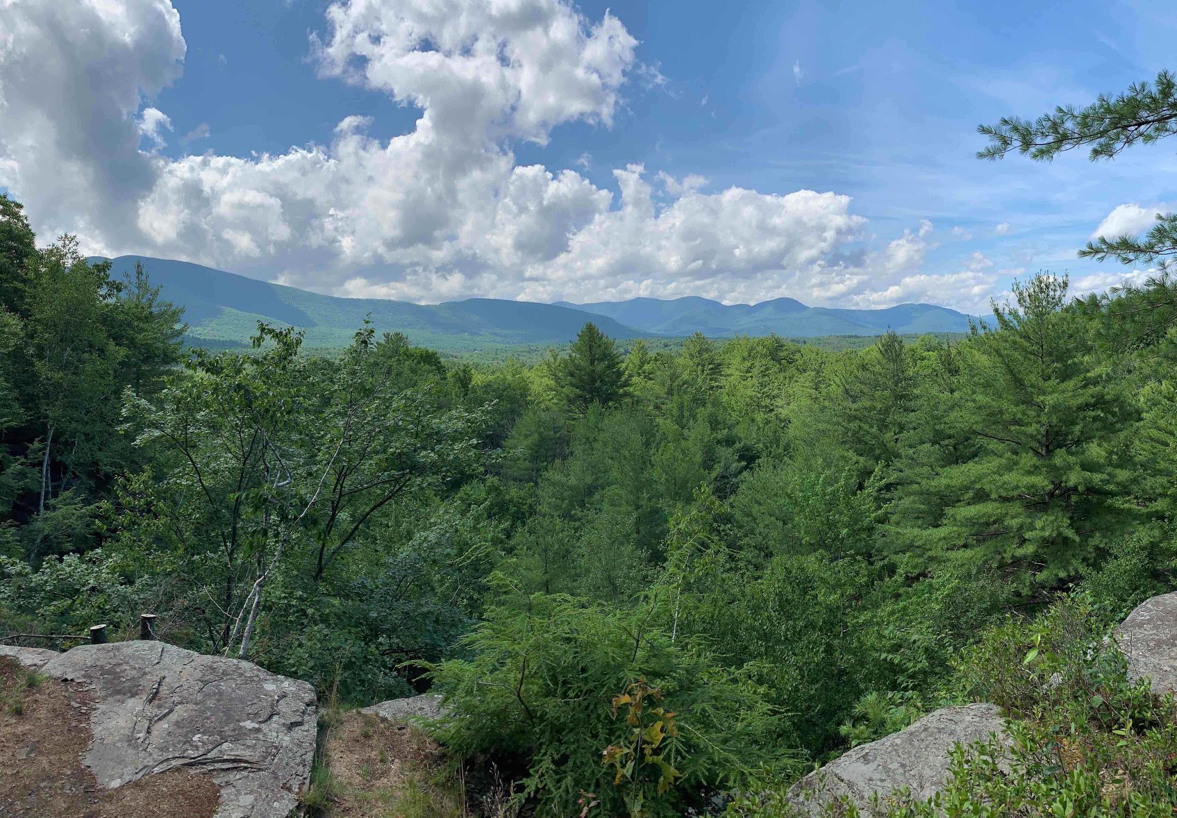
I continued up the trail, now ascending into the higher elevation, the October air cooling. I passed a couple, who looked like they hiked this trail often, descending: the last people I would see for the rest of the day. I reached the uppermost sections of the Dry Brook Ridge trail and spied the rocky ledge through the berry bushes before finding the curving side trail that led to it. The view from it was stunning, impressive, and on par with some of the best Catskill views. This view faced West, beyond the High Peaks of the Catskills and into the rest of the valley, lower mountains, and hilltops. The High Peaks of Graham and Balsam Lake Mountains were visible to the left, and to the far left I could see the rest of Dry Brook Ridge, curving and undulating before descending sharply into the valley separating the ridge from the peaks. There was the dried up Pepacton Reservoir, looking more like a low laying field than a body of water, as the view's centerpiece. I saw the valley and the warm houses lying low inside it. The view was spectacular, and I was instantly satisfied with this route, no matter what else it held in store. I was a view hunter, and this view was one of the last I had to capture before experiencing them all within the park.
I dropped the heavy pack, dug into it, and threw on all my layers. The wind was whipping the rocks below me, and the clouds had gathered on the horizon, creating wispy streams of mist, a light precipitation that rode the breeze into me. After an internal debate, I decided to take my dinner upon this rugged and windy ledge, as I wanted to enjoy the view and felt it was worth braving the wind and light rain. After all, the hot food would warm my body and, along with the view, my spirit as well.
I fired up the Jet Boil and began the cooking operation, glancing out into the cloudy valley and mountains, staring at the leftmost portion of the view and tracing tomorrow's route along the rest of the ridge, into the valley to reach the unseen road, and up the steep slopes to the faraway high peaks above. I tried to pick out the exact slope, the exact ridge and bump along the mountain that I'd be climbing. I enjoyed the hot soup and tea while the wind blew mist on me. I snuck in a couple of tokes with my back to the wind. I felt rugged and adventurous, the lone traveler, the lone warrior atop this mountain, braving the conditions for the pleasure of the view and the outdoors.
As I neared the end of my meal on the rocky ledge, I studied the cloudscape again and saw a curtain of dark gray concentrates, some of which dipped in surreal shapes and forms within the textured sky, twisting like little tornadoes, giving the scene an intense, supernatural feeling. I felt vulnerable facing those clouds. It looked like a portal into an alternative reality, and not necessarily a happy one, was approaching. The mist thickened, and I packed up my bag, followed the trail another few hundred feet, and stepped off into the wilds in search of a place to spend the night.
I crunched my way off the trail and into the forest of the ridge top, finding a relatively flat section of land. I counted my paces and estimated that I was at least 150 feet away from the trail, then searched for a clearing that was level enough to pitch my tent. After a short while, I came across a small fire ring, nestled in among the dried leaves and craggy branches. In an instant, I was overwhelmed by emotion. Someone before me – how long ago? – had gone through the same search for a campsite, and they had found it here, setting up a fire ring to make it homier and cozier. I felt a connection to this unknown person, and I wondered what their circumstances were like, what their life experience was that led them to this very place where my life had led me, in the here and now. I felt a bit lonely, my only relation to another person being this metaphysical connection to a stranger, but I was happy to have what seemed like the entire forest to myself. I knew I would make my camp in this area. I found a suitable place to pitch my tent, near the fire ring but a bit deeper into the woods, on a flat surface of leaves and dark soil, underneath a tall, leaning tree. The site reminded me of Giant Ledge, with the trail along a ledge with a spectacular view, and the campsite tucked away behind the ridge. I remembered the stunning night view from Giant Ledge and, after pitching my tent and setting up my backcountry campsite, followed my urge to experience the night view off the spiky cliff of Dry Brook Ridge.
I worked my way back and crashed through a group of thick trees, finding myself right on the trail, hugging the edge of the ridge, with a different but similarly jagged rocky ledge. This one was smaller than the one I sat at earlier, but it still provided an expansive view of the deep valley and surrounding mountains. Now, the thickening sky converged with the land at the horizon, blurring the distinction between the earth and the heavens. A blue haze pervaded the air, casting a dreamlike glow across the valley.
Deep inside the valley, two houses shined bright yellow lights into the night, the glow illuminating a small sphere around them before fading into the surrounding darkness. The houses were far away from me in distance, several miles across the forest and a few thousand feet below this cliff, but also in spirit. They were defenders of society, the tamers of the wild, while I was a mere visitor, only a temporary witness to this wild section of the earth, impenetrable to those without spirit or courage. I wondered what the people inside those houses were doing at that very moment, why they had turned on those lights, while I was standing solo atop the wet rocks of the mountain. Nearby, headlights from cars moving down a country road pierced the black forest before curving and fading back into it.
The sky continued to darken, and I stood at the cliff, feeling a thin veil of mist caressing the outsides of my synthetic layers. I stood and lost myself among the shadows and the lights, imagining the interiors of the houses and following the whips and curves of the headlights. Eventually, I realized that the misty wind was causing me to shiver, and I performed a final meditation of gratitude before heading back into the forest and finding my campsite.
I ducked inside the tent, covered myself with the sleeping bag, and wrote a passage in my notebook. When I later crept out of the tent to conclude my nightly routines, I emerged into a forest of mist. It had invaded the woods while I wrote in my tent, and I now found myself inside a cloud that had become stuck on the cliffs, as I had been earlier, transfixed by the grand scale of the world before me. However, the moon was out behind the mist, casting a pervasive glow into the atmosphere, illuminating the small pellets of moisture in the air as they waved past, creating a lingering light, like the sun's dip behind a mountain at sunset. I watched my breath trail off into the atmosphere.
My sense of wonder and adventure increased then, as I felt like I was on a quest on some mystical journey. The excitement was paired with a level of fear, as I was the only person in the vicinity in these wet and cold conditions. The fear was mitigated by the knowledge that, however I felt about it, I was about to spend the night right here. I turned low my thinking mind and replaced it with my feeling mind. I felt the awe and excitement of the magical misty cloud surrounding me, and I felt the necessity of warmth, dryness, comfort, and sleep. I brushed my teeth, stashed my bear can, surveyed the glowing mountain mist one last time, and crawled into the tent.
I did not experience any sustained period of good sleep, instead tossing and turning throughout the night, dozing only in small increments. After a few hours, I roused from another round of dozing and stumbled out of the tent into a drastically altered scene. The mist had lifted, revealing a brilliant, bloated moon that crowned the sky, casting a direct and bright glow across the land. The light was so intense that it made the night turn into a ghostly bright day, a spirits' noon time. It reminded me of the Lake Isle of Innisfree, where "Midnight's all a glimmer and noon a purple glow." Here I was on this mountaintop, with midnight all a glimmer in reality. It was thrilling, and the extreme cold did not prevent me from lingering in the white light, lost in this glimmering midnight, feeling the spirits' lively dances around me, friendly pale shadows, as they celebrated their high noon in the forest. The moon shined above the ridge, angling in toward my tent. I snuck back into my sleeping bag, still feeling the bite of the cold air, and observed the bright moonlight spilling into my tent. It flamed the ghostly glow into the interior of my little wilderness home, casting shadow puppet figures across the fabric, looking as real as the branches themselves. The wind increased the air's chill and caused the wet branches to shed their watery reserves, pouring another round of precipitation onto my tent. I lay in my tent, letting the wetness gather around the outside, staying dry and warm enough to be safe, though not entirely comfortable, and periodically opening my eyes to glance at the silver light surrounding me.
Kaleidoscope Fall
Waghkonk Notes, November, 2023 by Dave Holden
LIKE EMBERS FADING - As the fall colors of 2023 slowly dissipate, melting into the Catskills landscape, they gradually change into the more somber tones we associate with winter. Sort of like a fire, if you consider midsummer the highest fire-flame, then now you might see the embers fade, almost as if the fire is going out. Luckily for us, the fire of life in the earth never really goes out, but just hides in plain sight - hidden under bark or deep in root, waiting for warmth to return. It’s almost like a fire that has been well-banked to keep the buried embers hot to wait for spring-time, the season of life, for them to be stoked back to warm, vibrant life.
AUTUMN WINDS - Winds of seasonal change blow across these ancient hills, lifting dry leaves from their now sapless branches, momentarily making a swirling leaf-devil, before depositing skittering multicolored little beauties onto bench, window-sill and doorway. Late Fall has come to our corner of the Catskills. This wind can be a cold blast from the north or its warmer, southern-born cousin. It can pierce hastily-donned, long-misplaced warm clothing or it can gently caress the skin with its reminder of lost summer warmth. The winds of Fall have their own unique character, whether from the north or from the south. Either way they serve to remind us that much colder times are just around the corner. There is no season that quite compares to a northeast autumn, for not only do we have an incredible full-spectrum, multihued leafy pageant to gape at, all of us oohing and aahing as if we had never seen it before (and, in truth, each Fall is unique and amazing in its own right). Sometimes Mother Earth cooperates and warms October up for us, like she did this year. It seemed like we were living in a wonderful fantasy-land (we do), a bright colorful world that is also comfy and warm, allowing us to walk in the woods in shorts, while wading through piles of dried leaves - all with the extra advantage of no black-flies or mosquitos! The only insect-life to speak of now are the last few butterflies - Cabbage Whites mostly, a couple of stray bees, Ladybugs, lots of Stinkbugs, as well as crickets and the very last few Katydids, not giving up and being very persistent, almost in a desultory fashion. Like the ultimate child that will not go to bed. The last of the Green Darner dragonflies have finally departed south. Yes, we'll still find an ant or two under rocks and an impending warm-spell (even just one day) will bring out more stubborn insects, happily fooled by the brief seeming return of summer. Of course, this occasion will make our wintering small-birds - Bluejays, Cardinals, Chickadees, Juncos, Sparrows, Wrens very happy to have more to feast upon, allowing them to put off their winter diet of berries and seeds.
THE FALL FOREST - I wonder how the forest thinks about the impending winter. I say it that way because I believe the forest is one entire being, each tree just one part of it. I think trees always communicate, whatever the season, through their roots, which are all intertwined - just like how their (our?) lives are. That wind I mentioned before, as it races through the trees, stripping them bare of this year's leafy bounty, is helping the trees, or, perhaps over untold millennia the forest has learned to adapt to having the wind help them shed their dried parts, blowing them to the forest-floor, where first the leaves protect the roots from the worst of winter's cold, then they become another layer of soil for the following season. Pretty darn smart, I'd say. Also, very egalitarian, in that you'll notice that a Beech probably doesn't care if Maple leaves help mulch its roots, nor does the Oak-tree reject the Ash-leaf. I wonder, though, if maybe the hardwoods are not happy to have the more acidic needles of Cedar, Hemlock and White Pine bedding over their rootlets. And keep in mind how important the roots are, preserving the trees vital sap safely underground for the duration of winter. Because the sap is no longer in the branches this allows their limbs to survive the coldest time, when any sap left in a branch or twig would freeze, causing it to split and probably die off, its pith exposed. Another brilliant (in more ways than one) aspect of this is that the branches are much more flexible without their sap, allowing them to bend and bow with the onslaught of the fierce winter winds yet to come. Luckily, for now, we only have the gentle fall breeze to bounce around this years dried crop, scraping along the ground, catching on stick or stone. Or was that the Little People, as the traditional New Year (All Hallows Eve, Samhain) is upon us and the Gate Between The Worlds opens ever-so-gradually, just a crack and just enough for Visitors? Hmm.
KALEIDOSCOPIC - It is such a season of hyperbole. How can we consider autumn without expressing its beauty in extremes? Well, I guess it’s my turn. Living in a northeast fall is like living in an immense living kaleidoscope, with all the colors and every shade thereof surrounding you. As if that wasn’t enough, the very dynamic nature of this time is truly mind-boggling. Again, using the kaleidoscope analogy, with each turn (each day? each hour? each minute?) something changes, continually altering our perception. One moment a stand of mixed hardwoods and pines will be standing there, in all its colorful, yet mute, glory. The next moment a cloud is moved by wild fall winds and the sun shines brightly, back-lighting through the same trees that were so beautifully muted only moments ago, making them into intensely blazing beauties of fall forest life. And then, again, no sooner had you said “wow!” when another breeze comes up, inverting those same leaves, exposing their silvery undersides and stripping others off entirely, throwing them madly across the sky. Amazing and awesome are just two words that come to mind. As this kaleidoscope inexorably turns, the once-bright autumn hues, which only recently seemed stunningly immutable and starkly in-your-face, have changed their visual tune. Now they speak to us in more muted, darker tones of faded yellow and orange, rich browns and disintegrating greens. I’m almost afraid of what they’re trying to say. I think it’s something like “Winter is coming! Get used to somber shades, people!”. For that is what is upon us now and it seems that late Fall is the visual practice-palette for the even more subtle shades of winter, which is rapidly approaching.
Thank you all for accompanying me on this incredible journey through the seasons here in Waghkonk, “Land of Waterfalls Under the Sacred Mountain” (one interpretation, anyway, but I think it fits). Take Care, "Ranger" Dave Holden / (845)594-4863 / woodstocktrails@gmail.com / Dave Holden on Facebook / rangerdaveholden@Instagram.com / www.woodstocknytrails.com
Hike to Dry Brook Ridge, September 9, 9AM

Enjoy a hike in the Western Catskills with this 7-8 mile out-and-back, moderate-to-difficult hike to Dry Brook Ridge, which is a requirement for the Catskill Mountain Club's grid. The hike is not too strenuous (about 1500’ elevation gain), and it has a handful of very nice viewpoints along the ridge. It's a pretty hike in the woods to enjoy nature. There's a short herd path (a little bushwhack) that leads to the summit. We'll either eat lunch near the summit or retrace our steps to enjoy our lunch at a better viewpoint.To register for this hike, please contact Siu S. Yuen via email at ssyuen@msn.com by 6PM on September 8. Participants need to bring at least two liters of water, lunch, snacks, sunscreen, bug spray, and most importantly, sturdy hiking boots. Dogs are not permitted on this hike. The rain date is September 10.We will meet at the Hill Road Trailhead parking area and be ready to go at 9AM. To reach the Hill Road parking area from the east, take State Route 28/30 1.9 mi. miles west from Fair St. Margaretville and turn left, following the signs for the Hill Road Trailhead. From the west, take State Route 28/30 east 1.2 miles from the junction of State Routes 28 & 30 at Dunraven and turn right, then following the signs for the Hill Road Trailhead. The GPS Coordinates for the Hill Road Trailhead are 42.116056, -74.646553.
Through Hike and Clear Brush on the Plattekill State Forest Road, 9 AM Saturday, August 5
Join a group of volunteers who will complete the reopening of the Plattekill State Forest Road in the towns of Bovina and Middl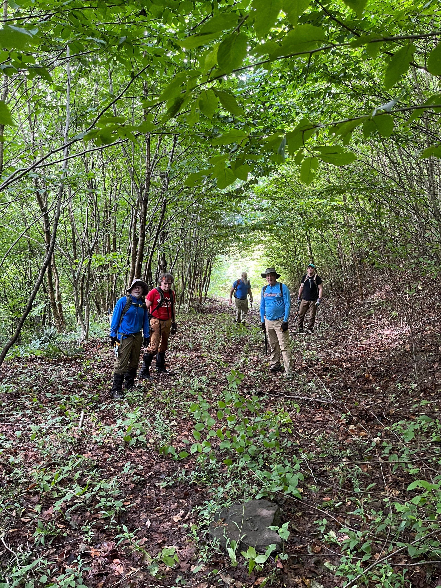 etown This is a 5.5 mile point-to-point hike that will include brush trimming and limb lopping. Carpooling is necessary. Join with your friends to preplace a vehicle in the town of Middleton, then drive back to Bovina (11 miles) to begin the hike. Or, carpool with existing volunteers, space allowing.Participants should bring a pair of loppers and a handsaw, as well as lunch, snacks, sturdy boots, insect repellent, and plenty of water. The hike is rated moderate-difficult and is expected to take six hours. Dogs are not permitted on this hike. For more information, including directions and carpooling, contact Peter Manning at Peter@catskillmountainclub.org by 5PM Friday August 4.
Hike Black Dome and Thomas Cole, Saturday, August 12 8:30 AM
Join Siu S Yuen for this difficult 6.5-mile, out-and-back hike to Black Dome (3,980 ft.) and Thomas Cole (3,950 ft.). We'll take the Black  Dome Range trail (red), cross the Batavia Kill, and ascend steeply to the ridgeline with viewpoints. We'll continue on the trail over Black Dome and on to the wooded summit of Thomas Cole. After a pause at Thomas Cole, we'll retrace our steps and break at the viewpoint looking south from Black Dome. From here, we’ll head down the trail and back to our cars.The hike is expected to take five hours. Participants should bring lunch, at least 2 liters of water, snacks, maybe sunscreen, bug spray, and most importantly, sturdy hiking boots. Dogs are not permitted on this hike. Participants must register by 6 p.m. on Friday, 8/11/2023 by contacting Siu S Yuen at ssyuen@msn.com The rain date is Sunday, August 13.DirectionsFrom (Ext 20) in Saugerties, take 32 North for 6 miles, keep straight onto NY-32A / Route 32A for 1.3 miles, keep right to stay on NY-32A / Route 32A for 0.6 miles, bear left onto NY-23A / Route 23A for 5.5 miles, turn right onto County Route 25 / County Hwy-25 for 2.7 miles, bear right onto County Route 23C and stay on it for 4 miles, turn right onto Maplecrest Rd / County Hwy-40 for 1.9 miles, turn right onto County Hwy-56 (Big Hollow Rd) for 4.3 miles until the end and park in lot at the end. Meeting location GPS coordinates: N42.2886 W74.1143.From Exit 20 (Saugerties) NYS Thruway, take NY 32 north for six miles and keep straight onto NY-32A. Take NY-32A for 0.6 miles, bear left onto NY-23A. Take Route 23A for 5.5 miles, turn right onto County Hwy 25. Take County Hwy-25 for 2.7 miles, bear right onto County Route 23C and stay on it for four miles. Turn right onto Maplecrest Rd. (County Hwy 40), go 1.9 miles, then turn right onto County Hwy 56. Take County Hwy 56 (Big Hollow Road) for 4.3 miles until the end. Park in lot at the end of the road. Meeting location GPS coordinates: N42.2886 W74.1143.From NY-23 in Windham, take 23 east to NY-296; turn right on 296 and take 1.5 miles and stay straight (296 goes left) onto Co. Hwy 40 (Maplecrest Rd.) and continue two miles to Maplecrest and turn left onto Co. Hwy 56 (Big Hollow Road) for 4.3 miles until the end. Park in lot at the end of the road. Meeting location GPS coordinates: N42.2886 W74.1143.From NY-23 in East Windham, take 23 west to Co. Hwy 65 and turn left onto 65A. Take 65A, this merges with Co. Hwy. 40, and continue three miles to Maplecrest. turn left onto Co. Hwy 56 (Big Hollow Road) for 4.3 miles until the end. Park in lot at the end of the road. Meeting location GPS coordinates: N42.2886 W74.1143.

CMC Mini-Golf Fundraiser June 30, 5-7 PM
Looking for a laid-back event to kick off the July 4 weekend and support CMC? Then please join us for our Mini-Golf Fundraiser on June 30, 5-7 PM at Putt Putt Van Winkle. Enjoy a one-of-a-kind mini-golf experience with food, drink, and prizes in the scenic town of Bovina.Your participation in this event will help support CMC’s free outdoor recreation activities, trail construction and  maintenance programs, hiking challenges, advocacy for sustainable use of the Catskill Park and region, and our educational outreach programs like Views from the Watershed and Speak to the Earth.Cost of the event is $50 per person. Rain or shine (tents on site). REGISTER HEREPutt Putt Van Winkle is in the Western Catskills. From Andes, take Route 28 north 4.7 miles and to County Highway 6. Turn right and go 4.7 miles. Putt Putt Van Winkle is on the right. From Delhi (traffic light at Rtes. 10 and 28) take Route 28 south 7.5 miles to County Highway 6. Turn left and go 4.7 miles. Putt Putt Van Winkle is on the right. From Stamford (junction of Routes 23 and 10), take Route 10 south and go 8.1 miles to South Kortright. Turn left at blue and yellow sign for County Highway 18. Go over bridge and turn right at stop sign. Continue 1.2 miles to County Highway 5 and turn left. Continue on Highway 5 for 1.3 miles and bear left onto New Road. Take New Road 3.5 miles to the stop sign at the end. Putt Putt Van Winkle is across the road.For more information, please contact Peter@catskillmountainclub.org
POSTPONED TO 7/23 Hike to Slide Mountain, the Catskills’ Highest Peak, NOW July 23, 9 AM
This 11.2-mile hike, beginning at the Denning Trailhead, offers a chance to take a lesser-traveled route to Slide Mountain. This outing will include 2100’ of elevation gain and is expected to take 8-10 hours. Though rated difficult, the hike will follow marked trails and pass thr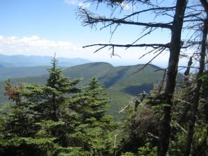 ough a variety of forest types and trailside environments and include some open views.Hikers must register for this event by contacting leader Al Purdy, either by email Albertpurdy1@aol.com or phone (845) 489-2332 by July 21. Space is limited.Participants need to bring lunch, as well as a lot of water, headlamp or flashlight, rain gear, sunscreen, and insect repellent. The ability to filter water would be a plus. Dogs are not permitted. Heavy rain or severe thunderstorms cancels the hike.From the NYS Thruway Exit 19 Kingston, bear right onto State Route 28 West and go 30 miles to Big Indian. Turn left at Big Indian onto Ulster County Route 47 (Oliverea Road) and go south for 20.3 miles. Turn left onto Sullivan County Route 19 (Denning Road); go through the hamlet of Claryville, pass back into Ulster County, and follow this road for 7.7 to the DEC parking area at the end of the road. From Margaretville, turn left onto State Route 28 from Bridge Street and follow for 12.3 miles. Turn right onto Ulster County Route 47 (Oliverea Road), follow for 20.3 miles. Turn left onto Sullivan County Route 19 (Denning Road), pass back into Ulster County, and follow this road for 7.7 to the DEC parking area at the end of the road. GPS Coordinates: N41 57.9545 w74 27.144
Hike Hunter and Southwest Hunter Mountains – July 22, 8:30 AM
This is a 10-mile strenuous loop hike to SW Hunter (3,750 ft.) and Hunter (4,040 ft.), which is the second highest of the Catskills High Peaks. We'll take the Diamond Notch Trail (blue) to Devil's Path (red) to where we'll have our first view at Geiger's Point. We'll take a herd path to SW Hunter where we'll retrace our steps for a bit, and then we'll continue via the Devil's Path to the summit of Hunter. The fire tower offers outstanding views and there is a nearby viewpoint looking out over Southwest Hunter and beyond. Continuing from Hunter on the Spruceton Trail (blue), we’ll make a short stop at John Robb lean-to and view before we loop out to our cars. 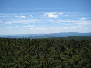
Participants need to bring lunch, at least 2 liters of water, snacks, maybe sunscreen, bug spray, sturdy hiking boots. Pre-registration is required by 6 PM July 21. Please contact leader Siu S Yuen via email ssyuen@msn.com This hike is expected to take seven-eight hours. Dogs are not permitted. The bad weather date is Sunday, July 23.From the traffic circle at Kingston/ Exit 19 NYS Thruway, take NY-28 west for 27.6 miles, turn right onto NY-42 and go 7.3 miles, then turn right onto Spruceton Road/County Highway 6 and go 6.7 miles and park at the first lot on your left (the lot with the horse ramp). (The NY-28/ 42 junction is 3.1 miles east of Big Indian.)From NY-23A go the junction with NY-42 at Lexington; take 42 south for 4.1 miles and turn left on Spruceton Road/County Highway 6. Go 6.7 miles and park at the first lot on your left (the lot with the horse ramp). (The NY-23A/ 42 junction is 6.3 miles east of the junction of NY-23A/ 23 in Prattsville and 7.7 miles west of the junction of NY-23A/ 296 in the village of Hunter.)
Hike Arizona and Blackhead Mountains, August 13 9AM
Enjoy this 9.5-mile hike, beginning at the Stork’s Nest Parking area, climbing Dutcher Notch, and reaching the Arizona (3413’) and Blackhead Mountain (3940’) summits. This scenic trail hike is rated as difficult, includes 2728’ of elevation gain, and will take six-to-eight hours. Participants need to bring lunch, a lot of water, headlamp or flashlight, rain gear, sunscreen, and insect repellent. Participants must pre-register by August 11 by contacting leader Al Purdy via email Albertpurdy1@aol.com or by phone (845) 489-2332. Dogs are not permitted; and severe weather cancels the hike. From NYS Thruway Exit 21 Catskill make a left at traffic light, go approximately 0.4 miles and turn right on Route 23 West. Go 5.2 miles and turn left onto Silver Spur Rd. Take Silver Spur Rd. for 1.3 miles then turn right and an immediate left onto the Mountain Ave. Take Mountain Ave. .75 and stay left on Co. Rte. 39. Take 39 1.25 miles to stop sign. Continue straight across intersection onto Maple Lawn Road for 1.25 miles. Turn left and make first right onto Storks Nest Rd. Continue to end of Storks Nest Road and parking area is on the left. GPS coordinates of trailhead: 42.252398, -74.053720From Windham (at the junction of State Route 23 and County Route 21), take Route 23 East 11.9 miles and turn right onto Hearts Content Road (Co. Rte. 31). Take Rte. 31 for 3.5 miles and turn right onto Maple Lawn Rd. Take Maple Lawn Rd. for 1.25 miles. Turn left and make first right onto Storks Nest Rd. Continue to end of Storks Nest Road and parking area is on the left. GPS coordinates of trailhead: 42.252398, -74.053720
Hike the Huckleberry Loop, Sunday September 17, 9AM
Enjoy a day in the Western Catskills by hiking the complete Huckleberry Loop Trail, a distance of 12.8 miles. Rated as difficult, this loop hike will begin at the Hill Road Parking Area and will proceed counter clockwise until again reaching Hill Road in approximately eight hours.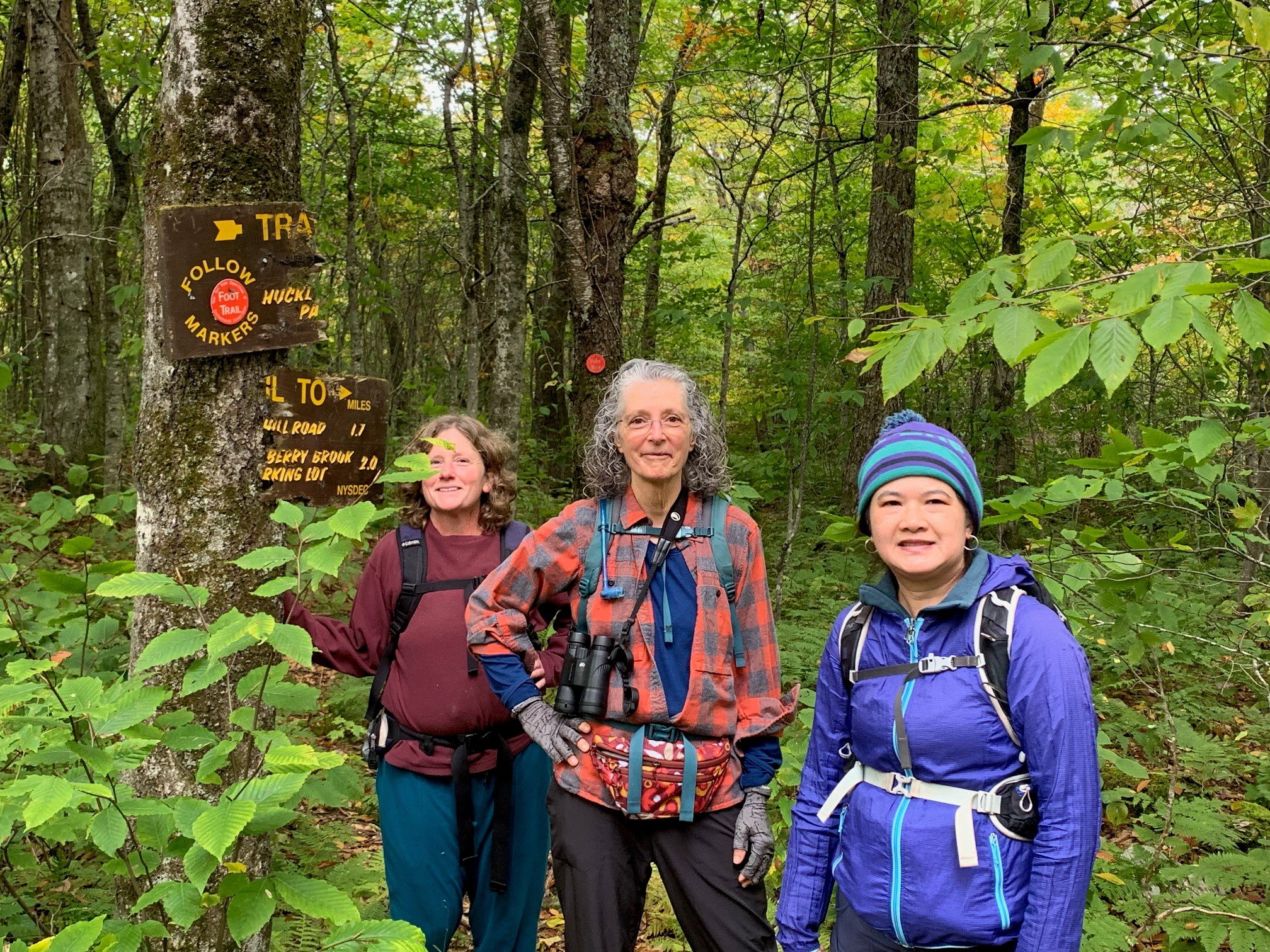 Registration is required. Please contact Al Purdy at Albertpurdy1@aol.com or (845) 489-2332 by September 15. Participants need to bring lunch, snacks, plenty of water/ beverages, a flashlight or headlamp, and sturdy hiking boots. Dogs are not permitted on this hike. Severe weather will postpone the hike.To reach the Hill Road Trailhead from the east, take State Route 28/30 1.9 mi. miles west from Fair St. Margaretville and turn left, following the signs for the Hill Road Trailhead. From the west, take State Route 28/30 east 1.2 miles from the junction of State Routes 28 & 30 at Dunraven and turn right, then following the signs for the Hill Road Trailhead. The GPS Coordinates for the Hill Road Trailhead are 42.116056, -74.646553.
Dry Brook Ridge & German Hollow Trail Maintenance, Sunday, June 4 10:00 AM
Join Laura Battelani, CMC Board Member, and David Lucas, NY/NJ Trail Conference volunteer as they maintain their adopted trails.  After meeting at the car wash in Margaretville, we will drive to the Hill Rd. Trailhead and climb approximately 1500 feet moderately and do light trail clearing, making sure things are tidy on Dry Brook Ridge. We'll then hike the ridge, passing by a 700-year-old bog, and arrive at a beautiful lookout of the Pepacton Reservoir from almost 3500 ft. of elevation. We will relax here and have midday lunch, with beautiful western views of the Western Catskills. In the afternoon, we will return on the German Hollow Trail, maintaining along the way. Pack lots of water and your lunch and snacks. Wear comfortable layers. Bring a hat, bug spray, and rain gear.Event Duration: 6 miles, 7 hoursLevel of Difficulty: Moderate-DifficultLeader: Laura Battelani, CMCBring: Water, lunch/snacks, sturdy hiking boots, rain gear. Wear comfortable layers. If you also want to help with the cleaning of the trail, bring hand clippers, loppers, and a foldable saw if you have them, and gloves and eye protection.Registration required by 6/3/23. Register by contacting the leader: bodyworx@catskill.net or (845) 586-3101Dogs allowed: No, please.Additional Information: Rain date: TBDDriving and Meeting Directions: On Route 28, go west 43 miles from the traffic circle at the NYS Thruway Kingston to the Village of Margaretville. Go past the first right turn to Margaretville (with the blinking light) and turn right at next, Fair St. intersection. The meeting place is at the car wash on Fair St. From Route 28 west, Fair St. is the first left turn to Margaretville.GPS coordinates: 42.144367, -74.652100
Hike to Windham High Peak – Sunday, June 11 9:00 AM
Join Al Purdy on this 7.5-mile round-trip hike to this 3524’ mountain in the northeast Catskills. This is a moderate-difficult trail hike that will take approximately six hours, beginning and ending at the Escarpment Trail Parking Area on Route 23 in the town of Windham. Participants need to bring lunch, 2-3 liters of water, and insect repellent. 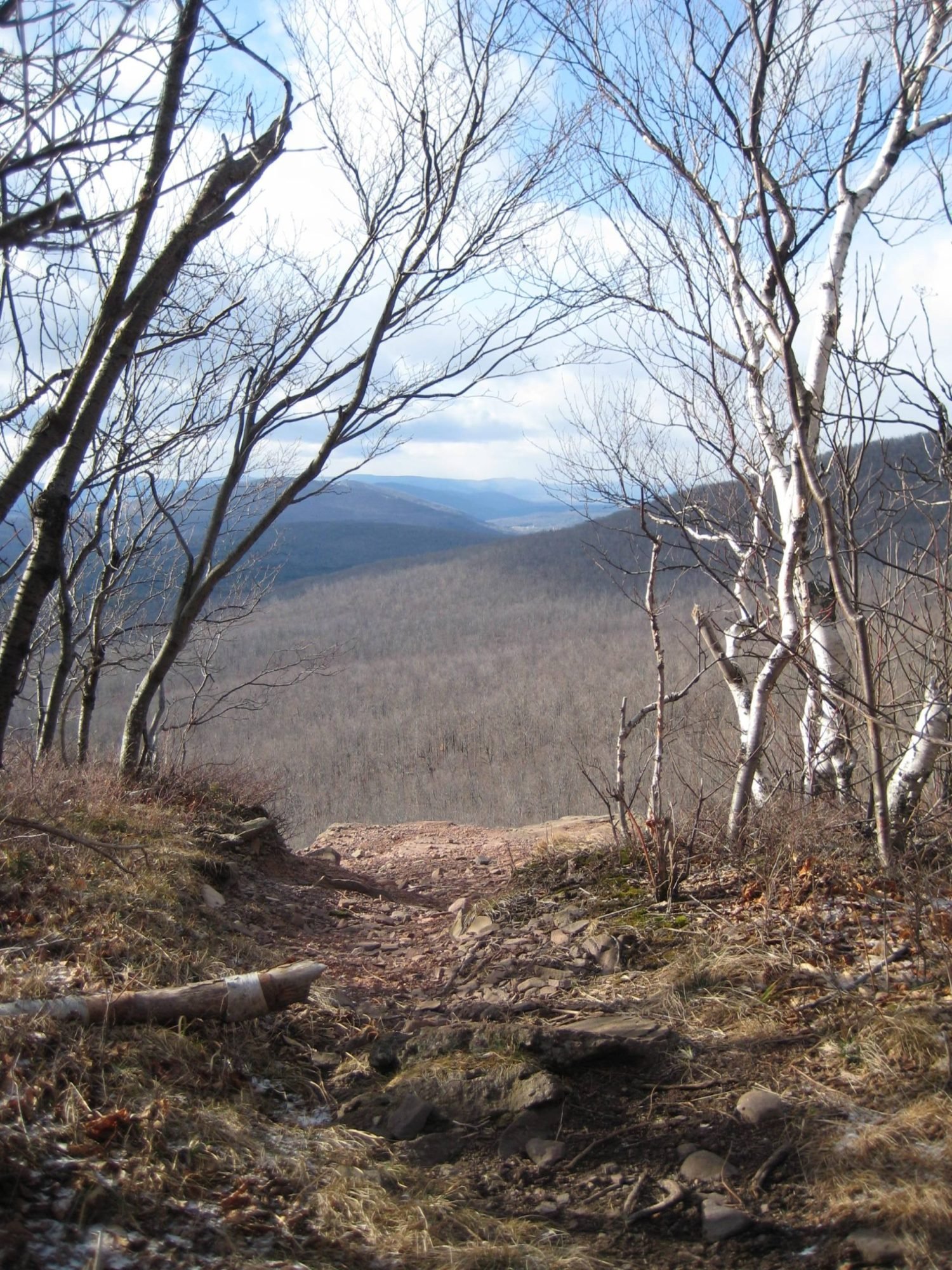
Registration and notes: You must preregister for this hike by June 9. To register, contact Al Purdy by email Albertpurdy1@aol.com or by phone (845) 489-2332. Heavy rain for the day or severe thunderstorms will cancel the hike. Dogs are not allowed on this hike. Maximum number of hikers is 12.Directions: From the NYS Thruway, take Exit 21 (Catskill); turn left from thruway entrance road and proceed a half-mile and turn right on State Route 23 (west). Follow Rte. 23 west for 19.5 miles and the Escarpment Trail/ Elm Ridge Parking Area is on the right, at the intersection with Cross Road. From Route 23 West, the trailhead is located east of the hamlet of Windham, 2.5 from Route 296 on the left side of the highway. GPS Coordinates: N 42.31259 W 74.19040
Cycle the Upper Pepacton Reservoir June 14, 5:00 PM
Meet at the Shavertown parking area for a 20-mile road cycling loop on State Route 30 and the BWS Roads toward Margaretville. We will ride at a moderate pace (14-17mph) for approximately 1 hr. 20 min. Participants will need a road bike, water, snacks  for the ride, and should have equipment to repair a flat tire. This ride is rated moderated - difficult.
Preregistration is required. Register by contacting Peter Manning via email Peter@catskillmountainclub.org by 8:00 PM on June 13. If the weather is bad, participants will be notified on the morning of June 14. If the weather looks favorable for the following evening (Thursday, June 15), we will ride at 5PM.Location and directions: The Shavertown parking area is located on NYC BWS Rd. 4, at its junction with State Route 30 (GPS Coordinates: 42.089561, -74.818429.) From the east, take Rte. 30 west from Margaretville. After three miles stay on Route 30 by turning left; then go another eight miles and turn right on BWS Rd. 4. The parking area is immediately on the left. From the west, take State Route 30 from Downsville. Go 14 miles, cross the reservoir, and turn left on BWS Rd. 4. The parking area is immediately on the left. From Andes, take County Highway 1 (becomes BWS Rd. 4) for almost eight miles and see the parking area on your right just before the stop sign/ junction with Route 30.
Hike the Shavertown Trail | Monday, April 17, 2023 @ 10:00 AM
 The Shavertown Trail begins with a moderately difficult climb to a woods road. From there it climbs gently to a lovely pond and beautiful views of the mountains over the Pepacton Reservoir. Beyond the pond is a moderately easy hike to the Tremperskill Overlook with another sweeping view of the valley and the reservoir. Event Duration: 3 miles, 4 hoursLevel of Difficulty: Moderate; 900′ elevation gain.Leaders: Wendell GeorgeRegistration required by April 15. Register by contacting the leader. See below.Group size is limited to 12, so register early.Bring: good hiking shoes, plenty to drink, lunch, moisture wicking layers that can be shed or added as neededDogs allowed: YesQuestions about this event can be directed to: Wendell@catskillmountainclub.org or 845-514-6959Driving Directions: From Margaretville follow SR 28/30 west to the intersection where SR 30 turns south (left). Follow SR 30 to the Shavertown Bridge. Immediately before crossing the bridge, turn north (right) to the parking area on the left.From Andes take CR 1 south to the Shavertown parking area on the right, just before the SR 30 intersection.GPS Coordinates: 42.089442, -74.81826
Paddle the West Branch of the Delaware – Saturday, April 22 10:00 AM
Kayak or canoe paddle from Delhi to Hamden on the West Branch of the Delaware River. Join Rick Roberts of the Catskill Mountain Club for this moderately rated eight-mile river trip. The event will begin in Delhi and is expected to take 4-5 hours, including the pre-placement of vehicles.  To register, contact Rick Roberts by email (hikerrick2000@yahoo.com) or by phone (607) 746-9694 by April 18; and read the following information:Event Duration: 8 miles, 4-5 hoursLevel of Difficulty: ModerateLeader: Rick Roberts, Catskill Mountain ClubBring: Water, lunch, your own personal watercraft and paddles, life jacket, rain jacket, an 8' length of rope, and sunscreen.Registration required: To register, contact Rick Roberts by April 18 by email (hikerrick2000@yahoo.com) or by phone (607) 746-9694.Dogs allowed: NoAdditional Information: We will be dropping vehicles off at the take-out site in Hamden prior to starting down the river. The water may be high at the time. If it is too high I will call off the paddle at least 2 days prior. All participants must be familiar with the use of their kayak or canoe. i.e., NO NOVICES for this paddle, please. Rain/snow date: TBD.Directions: Take NYS Rte 28 or NYS Rte 10 to Delhi NY. Launch site is behind the Parts Plus Auto parts store, Kingston St, in Hoyt Park on the river.Maximum Group Size: 10GPS Coordinates: 42.276061, -74.915774
Hike Rochester Hollow on John Burroughs’ Birthday – Monday, April 3, 9:00 AM
Join Peter Manning, CMC Executive Director for a four-mile, round-trip hike to the John Burroughs monument. This easy-moderate walk parallels a stream and follows the old road to the remains of Colonel William Rochester’s estate. The original Burrough’s monument was erected in 1921 following the naturalist’s passing earlier that year. A replica of the original plaque was dedicated in 2013.
The hike is expected to take 2.5 to 3.5 hours. Participants must bring any food or water they need. (See directions below.) To register, email Peter@catskillmountainclub.org by 6PM Sunday April 2.Event Duration: 4 miles, 2.5 to 3.5 hoursLevel of Difficulty: Easy - ModerateLeader: Peter Manning, CMCBring: Water, lunch/snacks, sturdy hiking boots, hiking crampons, snowshoes (as applicable)Registration required by 6PM 4/2/23 . Register by contacting the leader: Peter@catskillmountainclub.orgDogs allowed: No, please.Additional Information: Rain/snow date: TBDDriving and Meeting Directions: The Rochester Hollow Trailhead is located at the end of Matyas Road, which is a road that intersects State Route 28 between Big Indian and Pine Hill. The turn to Rochester Hollow is marked by brown-and-white wayfinding signs on Route 28.GPS coordinates: 42.11992508876182, -74.45160890320108