
Events
Calendar
Upcoming Events

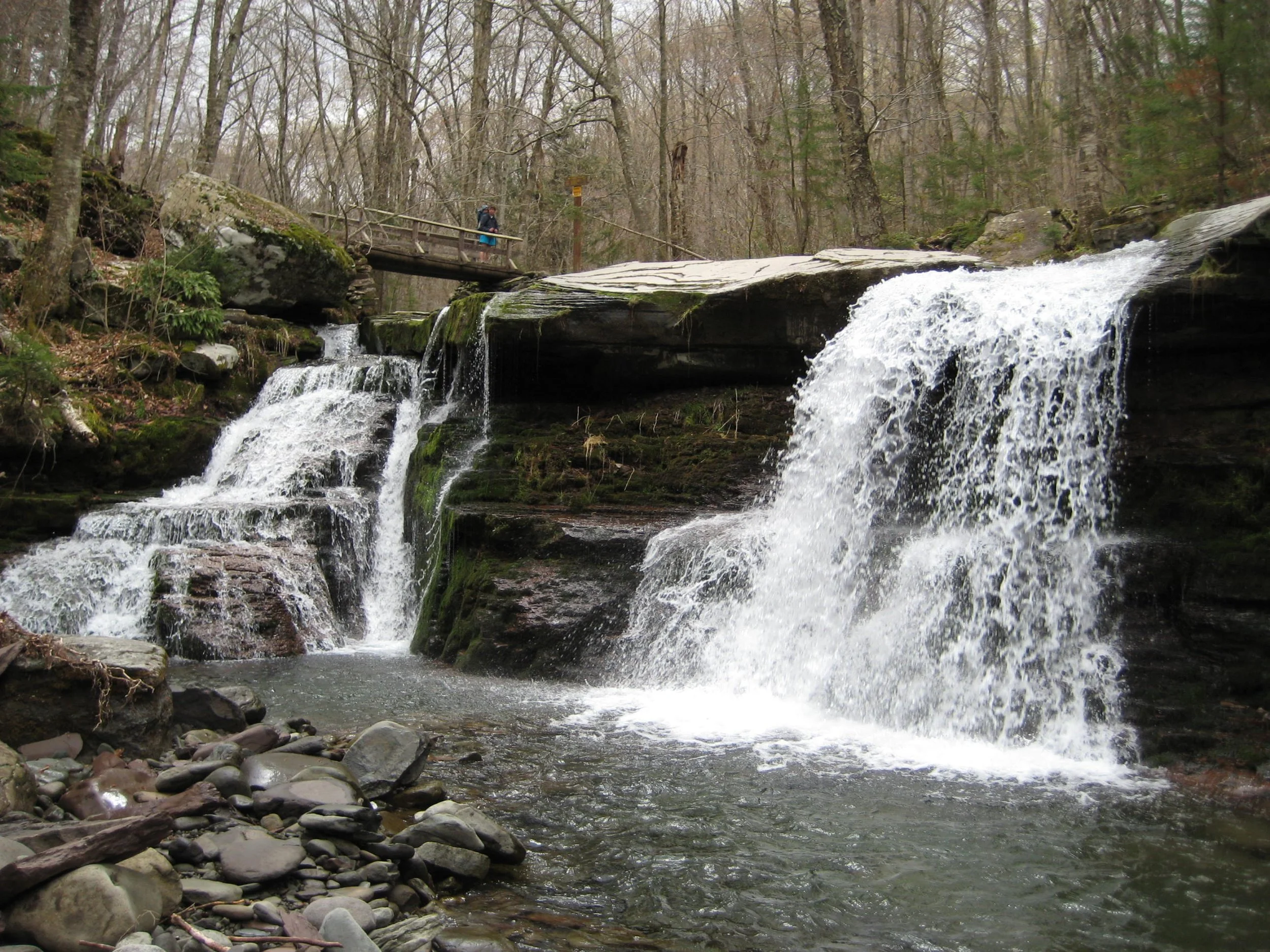
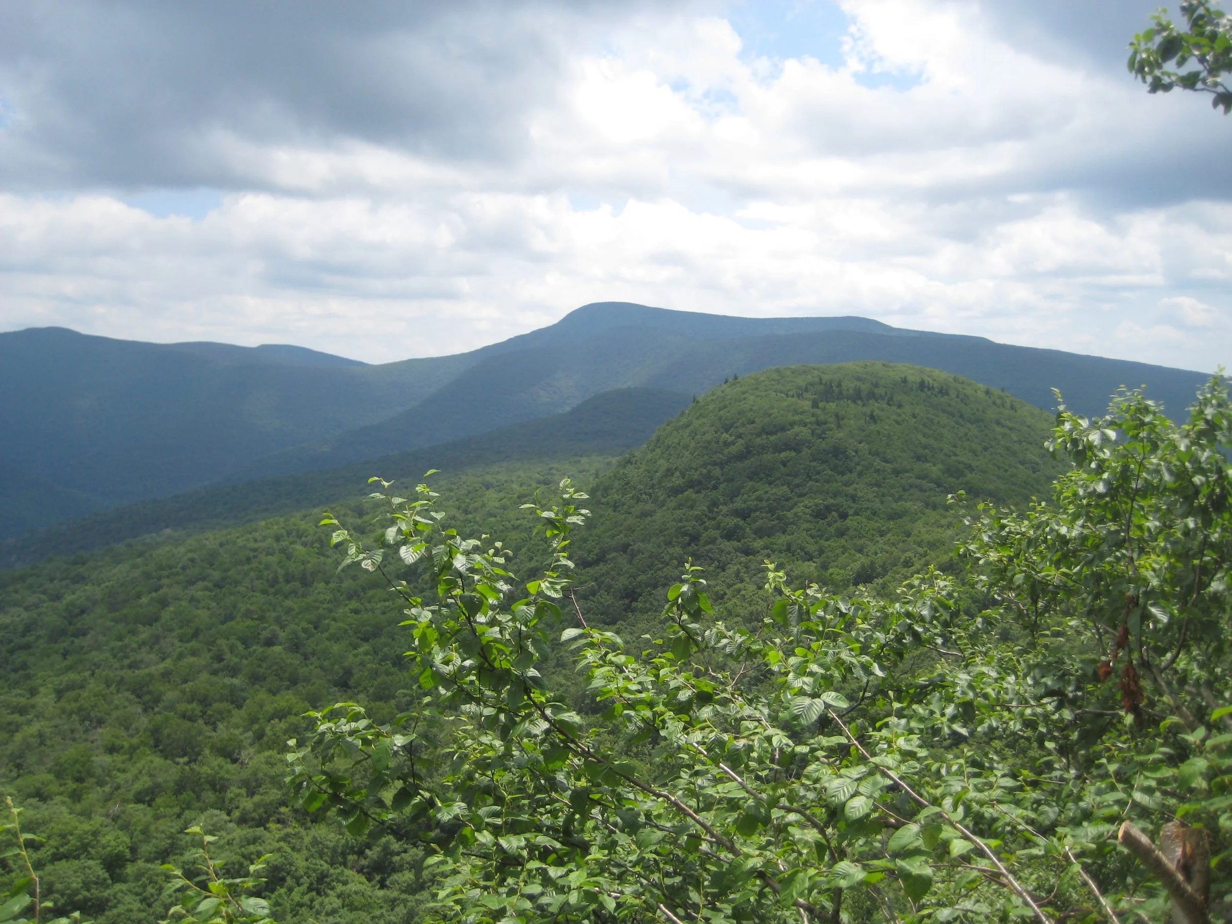
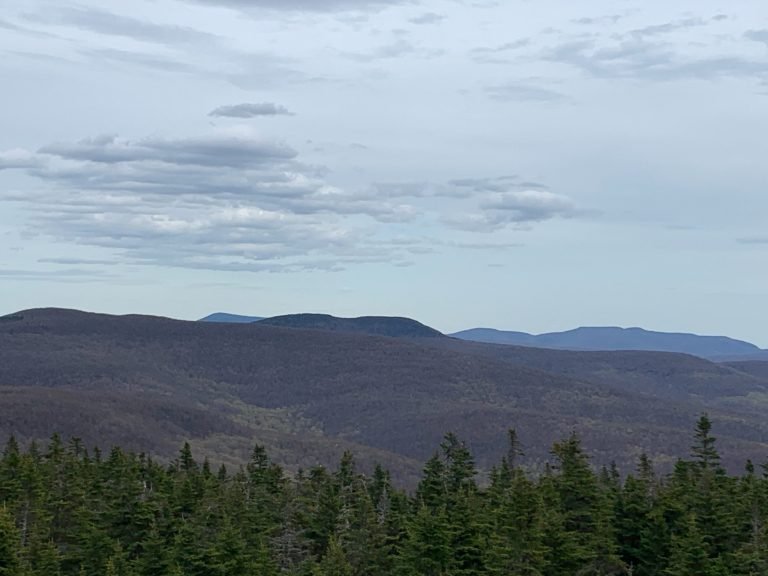
Fox Hollow-Panther Mountain-Woodland Valley Traverse
Join Anne Rubin for this point-to-point 10.3-miler along the Panther Ridge. We will meet at the Woodland Valley Campground at 7:30 am, then Shuttle to Fox Hollow Trailhead where we will begin the traverse at 7:45. This hike is rated moderated-to-difficult and is wholly on a marked trail. The duration of the hike will be determined via a detailed email to registrants.
Participants should bring lunch, snacks, water, beverage, sturdy hiking shoes, layers of clothing, rain gear, and insect repellent. This hike is limited to 12 people, and registration is required. To register, contact Anne Rubin at annaswartz@netscape.net by April 23. Dogs are permitted on this hike with the permission of the event leader.
Driving Directions: Woodland Valley Road is located off State Route 28, one half mile west of Phoenicia and marked with brown-and-white wayfinding signs. After turning on Woodland Valley Road and crossing the bridge, turn right, then stay to the left and follow Woodland Valley Road for 4.75 miles to the Woodland Valley Campground Day Use Lot (before the campground entrance) on the right.
GPS coordinates: 42.03625, -74.35763
Additional Info: https://www.mountain-forecast.com/peaks/Panther-Mountain-New-York/forecasts/1134

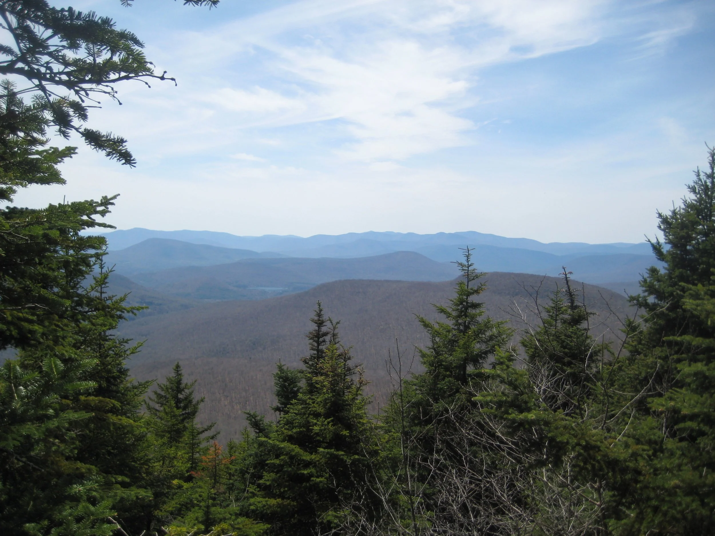
Hike Fir and Big Indian Mountains
Join Marv Freedman for this trail-and-bushwack hike to the summits of these wild peaks. This 10-mile outing that will take approximately eight hours and is rated as moderate to difficult. The pace will be moderate, about 1.5 mph moving speed with short breaks. Participants should bring lunch/ snacks, water/ beverage, head lamp, insect repellent sturdy hiking shoes, and hiking poles (optional). Dogs are permitted on this hike with the permission of the hike leader.
This hike is limited to 12 participants and registration is required before April 25. To register, contact Marv Freedman at marvfreedman@gmail.com
Directions: From State Route 28 in Big Indian turn south onto Ulster Co. Hwy 47 and continue 12.6 miles to the Biscuit Brook Trailhead on the left. From State Route 55 (just west of Grahamsville) take Sullivan Co. Hwy 19 (Claryville Road) north for 4.6 miles. Turn left onto Sul Co Hwy 157 (West Branch Rd.) and continue 8.1 miles (becomes Uls. Co. 47) and the Biscuit Brook Trailhead is on the right.
GPS Coordinates: 41.99125, -74.48484
Meeting place and time, route details, and required gear are subject to change based on weather forecast, trail conditions, etc. Updated information will be provided via email, usually about four days before the hike.

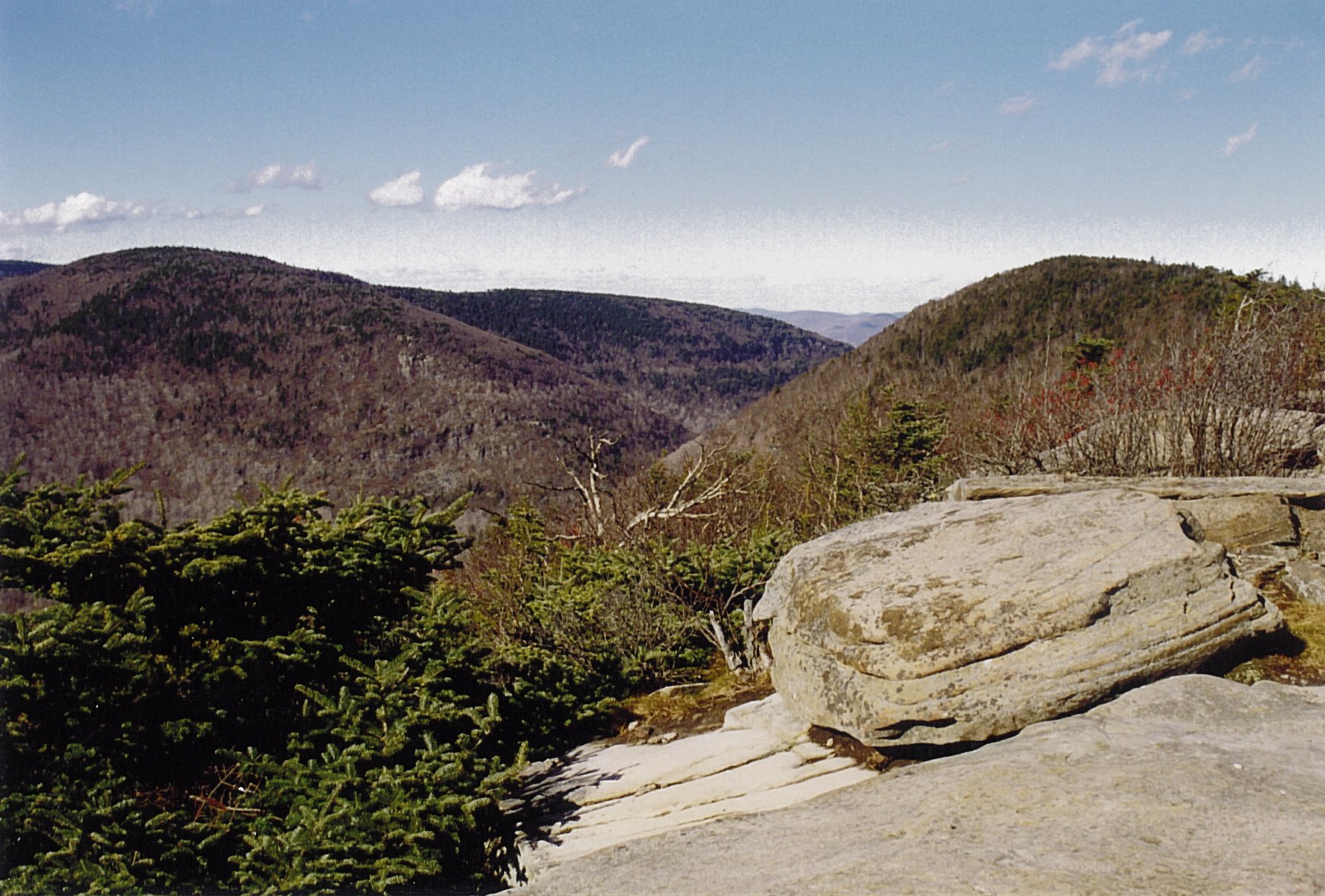
Hike Plateau, Sugarloaf, Twin, & Indian Head Mountains
This 10-mile hike traverses the easter section the Devil’s Path -- Plateau (3835'), Sugarloaf (3783'), Twin (3650'), and Indian Head (3573'). Rated as difficult, this hike has great views and is expected to take eight hours to complete. We will hike at a moderate pace (about 1-1/2 mph moving speed), with short breaks. Hikers should bring water/ sports drink, lunch/ snacks, sturdy boots, proper clothing, insect repellent, and a headlamp. Hiking poles are recommended.
This event is limited to 12 registrants and registration is required before April 27. To register, contact event leader Marv Freedman at marvfreedman@gmail.com Dogs are permitted only with the permission of the event leader.
Directions: To reach the Devil’s Path, Prediger Road Trailhead from State Route 23A in Tannersville, take South Main, stay left on Spruce (becomes Platte Clove Rd.) and at 1.5 miles stay left on Platte Clove Road and continue another 4.3 miles and turn right on Prediger Rd. The parking area is located off the end of this short road on the right.
From Route 23A west, take a right on Bloomer Road (.6 miles after the 23A/ 214 jnctn). Just after a mile stay to the right at the yield signs and onto Platte Clove Road (Co. Hwy. 16). From this point, continue on Co. Hwy. 16 for 4.3 miles and turn right on Prediger Rd. The parking area is located off the end of this short road on the right.
GPS Coordinates for Prediger Rd. Parking Area: 42.13391, -74.10368
Note: This is where our hike will end. We'll leave most cars here and will caravan to the end of Mink Hollow Road in Elka Park to start our hike.
Note: Prediger Road can be approached by ascending Platte Clove Road from West Saugerties; however, Platte Clove Rd. (gorge section) is a seasonal road and although it is scheduled to open on April 15, there is no guarantee that it will be open.
Additional Information: Meeting place and time, route details, and required gear are subject to change based on weather forecast, trail conditions, etc. Updated information will be provided via email, usually about 4 days before the hike.

Annual Ephemeral Wildflower Hike in Kelly Hollow

Trout Lily
This a chance to find and identify the beautiful Spring ephemeral wildflowers which are so named because they appear in early spring when they flower and fruit and then die back, all in a short period before the trees have had a chance to leaf out. Most hikers never see these flowers because they wait for late spring or summer to get into the woods. We will look for Trillium, Spring beauties, Trout Lily, Hepatica, Violets, Squirrel Corn, Dutchman's Breeches, Jack-In-The-Pulpit and many others. We may also find ramps and some early mushrooms. Kelly Hollow is one of the most beautiful short trails in the Catskills with rocky streams and waterfalls. It has a combination of coniferous and deciduous forests with a lovely abandoned beaver pond near a lean-to at the top. The trail is an easy to moderate loop of about 4 miles. Bring lunch and/or snacks to have at the lean-to (there is a privy nearby.) Co-leaders are Howard Raab and Wendell George. This outing will be about three hours in duration. See below to register.
Participants should bring a lunch/ snacks, plenty of water, insect repellant for ticks and blackflies, wear good hiking shoes, and dress in layers of moisture wicking clothing. Registration is required by May 3 and the hike is limited to 12 people. As this is a very popular event, we suggest that you register early. To register, contact Wendell George at wendell@catskillmountainclub.org or (845) 514-6959. Leashed or well-behaved dogs are welcome.
We will meet at the Kelly Hollow Trailhead at 11:00 am. The Kelly Hollow Trail is located on Millbrook Road in the town of Middletown, NYNJ Trail Conference map #142, F-5,6.
Directions: 2.2 miles West of Margaretville on Rt.28 go left across from the Old Stone School house and then right on the NYC reservoir road (BWT10) for 3.7miles. Then left on Millbrook Road for 5.3 miles to the trailhead parking area on the right.
GPS Coordinates: 42.07880, -74.65072
Additional info: In case of steady rain, the hike will be moved to Sunday, May 5th. If in doubt, call before 9:00 am on Saturday, (845)-514-6959 or (845) 586-3112.

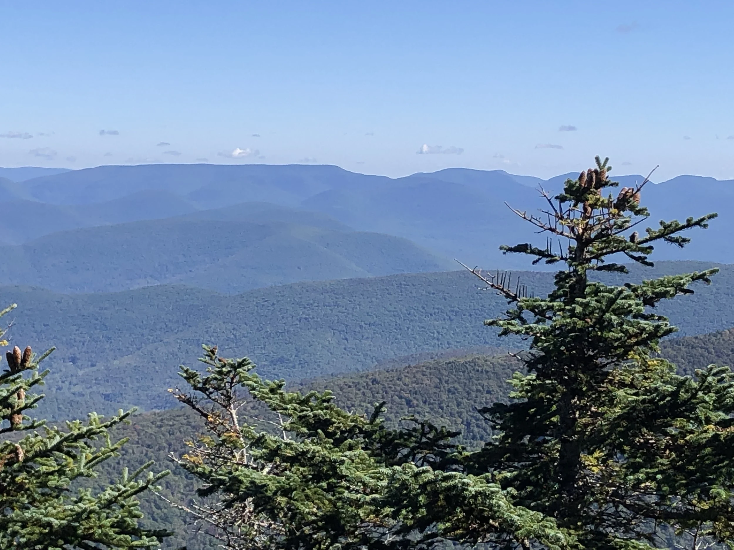
Hike the Neversink Hardenburgh Trail

Journey beside the headwaters of the Beaverkill and the Neversink along the Neversink Hardenburgh Trail. This 13.2-mile out-and-back hike will explore one of the less-frequented places in the Catskills. The hike is rated as moderate-to-difficult and is expected to take seven-to-eight hours.
Participants should bring lunch/ snacks, plenty of water/ beverage, sunscreen, insect repellent, rain jacket, an extra warm layer, and sturdy hiking shoes. This hike is limited to 12 participants, and registration is required by May 03, 2024. Register by contacting Al Purdy at Albertpurdy1@aol.com or (845) 489-2332. Dogs are not permitted on this hike.
Directions to Beaverkill Road Parking Lot:
From NYS Thruway Exit 19 (Kingston) turn right onto State Route 28 west and follow for 46.3 miles. Turn left onto route 30 follow for 8.3 miles. After crossing the Pepacton Reservoir, turn left immediately onto BWS road 8 for 1.9 miles. Stay right as BWS becomes Barkaboom Road - continue for 6.3 miles. Turn left onto Beaverkill Road follow for 9.5 miles to its end. The parking area will be on your right.
From Old Rte. 17 (west of Livingston Manor), take Beaverkill Road north. At 10.8 miles stay right and continue for another 9.5 miles to the end of the road. The parking area will be on your right.
GPS Coordinates for Beaverkill Road Parking Lot 42.02400, -74.59968
Notes:
Travel on cross mountain road a different route as described above is not recommended in poor weather conditions.
Steady rain or any other severe weather conditions will postpone the hike.

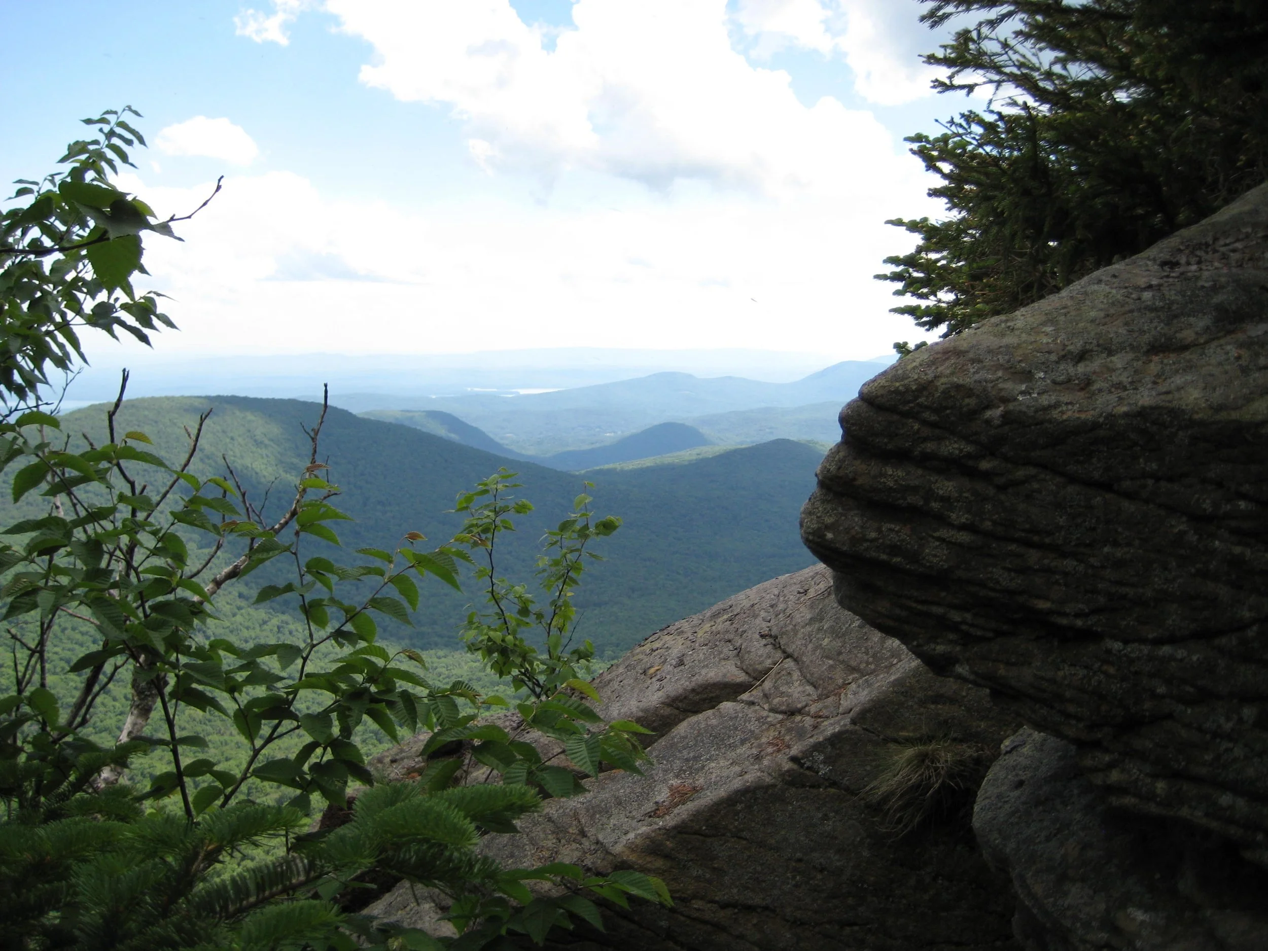
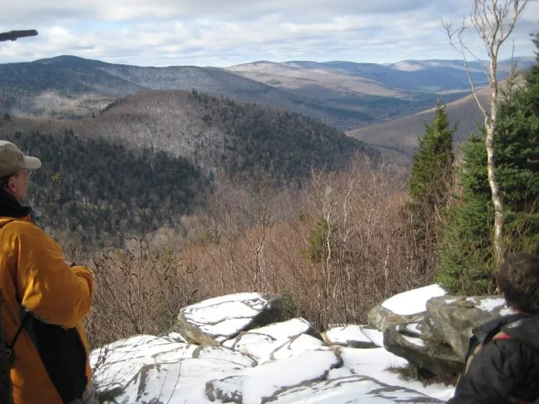
Eagle & Balsam Mountains from Seager to Rider Hollow

Balsam Mountain (Siu S. Yuen)
Join Marv Freedman for this one-way, 10-mile hike over Eagle (3583') and Balsam (3607'). The adventure will also include the ascent of Shandaken Hollow and the descent of Rider Hollow. Note, the stream crossing over the Shandaken Brook may be challenging. The pace will be moderate (about 1-1/2 mph moving speed), and this moderate-to-difficult rated hike is expected to take eight hours. Fit beginners are welcome.
Participants should bring lunch, hiking poles (recommended), headlamp, water/sports drink, snacks, insect repellent, sunscreen, sunglasses, two contractor trash bags, and two six-foot lengths of twine. Hikers must register for this hike by May 9. To register, contact Marv Freedman at marvfreedman@gmail.com. The hike is limited to 12 people. Dogs are permitted with the permission of the hike leader.
Directions: We'll meet at the Rider Hollow Trailhead, at the end of Rider Hollow Road, off of Todd Mountain / Galli Curci Road. This is where our hike will end. We'll leave cars here, and will shuttle to the Seager trailhead, at the end of Dry Brook Road, to start our hike.
To reach the Rider Hollow Trailhead from the east, take State Route 28 39 miles west from the traffic circle at Exit 19 (Kingston) of the NYS Thruway to Galli Curci Road at Highmount and turn left. (This is the same turn for the Belleayre Ski Center.) Proceed 4.95 miles on Galli Curci Road (Ulster Co. Hwy 49A) (becomes Todd Mtn. Rd.) and turn left onto Rider Hollow Road. Continue to the end of the road (2.1 mi.) to the trailhead.
From the west, take State Route 28 to Dry Brook Road (1.2 miles east of Margaretville) and turn right, following the signs for Dry Brook Ridge. Take Dry Brook Rd. 4.7 miles and turn left (following signs for Rider Hollow) onto Todd Mountain Road. Continue less than a half mile and turn right onto Rider Hollow Rd. Continue 2.1 miles to the end of the road/ trailhead.
GPS Coordinates for Rider Hollow Trailhead: 42.10212, -74.51734
Additional Information: Meeting place and time, route details, and required gear are subject to change based on weather forecast, trail conditions, etc. Updated information will be provided via email, usually about four days before the hike.
Hike to St. Anne’s Peak & West Kill Mountain
Hike to St. Anne’s Peak & West Kill Mountain

Beginning at the western end of the Devil’s Path, this hike will move along at a moderate-to-easy pace. This two-peak treat is rated as difficult and is expected to last six hours. We’ll pause along the way to enjoy nature’s treats, especially at Buck Ridge Lookout and Diamond Notch Falls.
Participants should bring lunch/ snacks, water/ beverage, as well as clothes and gear for the weather and trail conditions, e.g. proper clothing, micro-spikes if needed, sunscreen, and insect repellent. This hike is limited to 12 people and pre-registration is required by May 7. To register, contact Deanna Felicetta at felicetta.deanna@gmail.com or (845) 216-2021. Poor weather conditions will cancel the event. You can contact Deanna the evening before the hike between 4:00 and 9:00 PM. Dogs are not permitted on this hike.
Directions: We will meet near the end of the Spruceton Rd. (Greene Co. Hwy 6) at the Diamond Notch Parking Area. Note, this parking lot is on the right just past the Spruceton Trail Parking Lot (which is on the left). Do not park at the end of the road. Then we will shuttle back to the beginning of the hike, also on Spruceton Rd. Please drive slowly on Spruceton Rd.
From NYS Thruway Exit 19 (Kingston) merge onto NY 28 west for 27.6 miles. Then take State Route 42 north for 7.3 miles then turn right on County Hwy 6 (Spruceton Road) in West Kill and take this road 6.8 miles to the trailhead on the right, almost to the end of the road.
From State Route 23A at Lexington, take State Route 42 south for 4.1 miles then turn left on County Hwy 6 (Spruceton Road) in West Kill and take this road 6.8 miles to the trailhead on the right, almost to the end of the road.
Diamond Notch Parking Lot, GPS Coordinates: 42.18240 -74.26955

Giant Ledge and Panther Mountain

This out-and-back trail hike to Panther Mountain (3724') includes impressive views from Giant Ledge along the way. Fit beginners are welcome to join. With a 6.6-mile round trip distance and an elevation gain of approximately 1500’, this hike is rated as moderate. The expected duration of the hike is five hours.
Participants should bring lunch, hiking poles (recommended), headlamp, water, sports drink, snacks, insect repellent, and sunscreen. This hike is limited to 12 participants and registration is required. To register, contact hike leader Marv Freedman by May 13 at marvfreedman@gmail.com Dogs are permitted with the permission of the event leader.
Directions: We'll meet at the Giant Ledge Trailhead at the hairpin turn on Ulster Co. Hwy 47/ Oliverea Road. To reach the trailhead from State Route 28 in Big Indian, take Ulster Co. Hwy 47 south for 7.2 miles (following signs) and see the parking area just before the road takes a sharp uphill right turn.
GPS Coordinates for Giant Ledge Trailhead: 42.02651, -74.40350
Additional Information: Meeting place and time, route details, and required gear are subject to change based on weather forecast, trail conditions, etc. Updated information will be provided via email, usually about 4 days before the hike.


Indian Head Mountain Loop
Join Deanna Felicetta and others to enjoy the mountain shaped like a head! This is a challenging and fabulous hike along the easter section of the Devil’s Path, with some unique views and rock scrambles. Beginning and concluding in Platte Clove, this difficult hike is 8.2 miles and is expected to take 7.5 hours. The hiking pace will be steady but mellow. We will pause to enjoy Jimmy Dolan Notch, and our return route will depend on the trail conditions of the day.
Participants should bring lunch, snacks, plenty of water, sports drink, hat sunscreen, insect repellent, clothing layers, poles (recommended), microspikes as needed, jacket, and outdoor wear of the season. This event is limited to 12 people and registration is required by May 15. To register, contact Deanna Felicetta at felicetta.deanna@gmail.com or (845) 216-2021. Dogs are not permitted on this hike.
Directions: To reach the trailhead from State Route 23A in Tannersville, take South Main, stay left on Spruce (becomes Platte Clove Rd.) and at 1.5 miles stay left on Platte Clove Road and continue another 5.2 miles and the trailhead/ parking area is on the left. (Go slow in Platte Clove. Do not miss turn!!)
From Route 23A west, take a right on Bloomer Road (.6 miles after the 23A/ 214 jnctn). Just after a mile stay to the right at the yield signs and onto Platte Clove Road (Co. Hwy. 16). Continue to the point that is 6.3 miles and you will see the Long Path parking area (meeting place) on your left.
Note: Platte Clove Road, east of the trailhead is a seasonal road and its posted opening date (April 15) can vary from year to year.
GPS Coordinates: 42.13321, -74.08288
Additional Info: this hike is one in a series of hikes in honor and memory of Laura Smith, Deanna’s friend who loved hiking the Devil’s Path.

Hunter Mountain Loop Hike

Take a fun loop hike with Deanna Felicetta and others to the summit of Hunter Mountain, the second tallest Mountain in the Catskills. This hike features many views, a fire tower and cabin, the Devil’s Acre Lean-to, and Diamond Notch Falls.
This day in the outdoors is rated as difficult, as it will take approximately eight hours and cover 8.4 miles. Participants should bring lunch, snacks, plenty of water, sports drink, sturdy hiking shoes, changes of clothing, rain gear, sunscreen, insect repellant, and hiking poles (recommended). We will pause for photos at many scenic points.
Registration is required for this hike, which is limited to 12 participants. To register, contact Deanna Felicetta at felicetta.deanna@gmail.com or (845) 216-2021 by May 22. Dogs are not permitted on this hike.
Directions: From NYS Thruway Exit 19 (Kingston) merge onto NY 28 west for 27.6 miles. Then take State Route 42 north for 7.3 miles then turn right on County Hwy 6 (Spruceton Road) in West Kill and take this road 6.6 miles to the Spruceton Trail Parking Lot on the left.
From State Route 23A at Lexington, take State Route 42 south for 4.1 miles then turn left on County Hwy 6 (Spruceton Road) in West Kill and take this road 6.6 miles to the Spruceton Trail Parking Lot on the left.
GPS Coordinates of Spruceton Trail Parking Lot: 42.18437, -74.27219
Twin Twice on the Devil's Path

This out-and-back adventure is a scramblers delight! Also attractive for peak seekers and aspiring All Trails Challengers. From Roaring Kill we will ascend to Dibbles Quarry, Pecoy Notch, and Twin Mountain with its great views. We will then descend into Jimmy Dolan Notch and enjoy its view. Retracing our steps up Twin, we will enjoy these scrambles from a different point of view. Our pace will be moderate, though we will go slower and with extra care on the rocky sections. On our descent we will enjoy a quarry seat and view on our way back with fellow hikers. All told, we will cover 7.8 miles and be outside for eight hours.
Participants who would like to join this difficult hike should bring lunch, snacks, plenty of water, sports drink, extra socks and layers, rain jacket, hat, sunscreen, insect repellent, camera, and sturdy hiking shoes. Previous hiking experience is suggested. This hike is limited to 10 participants and registration is required. To register contact Deanna Felicetta at felicetta.deanna@gmail.com or (845) 216-2021 by June 5. Dogs are not permitted on this hike.
Directions: To reach the trailhead from State Route 23A in Tannersville, take South Main, stay left on Spruce (becomes Platte Clove Rd./ Co. Hwy 16) and at 1.5 miles stay left on Platte Clove Road and continue another 3.3 miles and turn right on Dale Lane. Continue 1.2 miles to the Roaring Kill Trailhead/ parking area.
From Route 23A west, take a right on Bloomer Road (.6 miles after the 23A/ 214 jnctn). Just after a mile stay to the right at the yield signs and onto Platte Clove Road (Co. Hwy. 16). Continue another 3.3 miles and turn right on Dale Lane. Continue 1.2 miles to the Roaring Kill Trailhead/ parking area.
GPS Coordinates of Roaring Kill Trailhead: 42.15120, -74.13102
Additional info: Rain, lighting, and high winds will result in the event being rescheduled. When registering, please leave full name and reachable phone number.

Vly & Bearpen Mountains (a.m.), Halcott Mountain (p.m.)

Join Marv Freedman and other hikers for this two-part outing to three high peaks. The day begins with a non-DEC trail hike to Vly Mountain (3541’) and Bearpen Mountain (3587’). The morning distance is 6.5 miles and the elevation gain is 2100’. This will be followed by a short, steep bushwhack in the afternoon to Halcott Mountain (3509’.) The afternoon distance is 3.5 miles, and the elevation gain is 1700’. The day’s pace will be moderate (about 1-1/2 mph moving pace) with short breaks. Overall mileage is 10 miles, and the duration will be about eight hours. Fit beginners are welcome to join. The day’s hikes are rated as moderate-to-difficult.
Participants should bring lunch, hiking poles (recommended), headlamp, water, sports drink, snacks, insect repellent, and sunscreen. This hike is limited to 12 participants and registration is required. To register, contact hike leader Marv Freedman at marvfreedman@gmail.com by June 13. Dogs are permitted with the permission of the event leader.
Directions: Parking is limited at the morning trailhead, so we'll meet in the parking area across from the Highmount Post Office at 8 Galli Curci Road, in Highmount NY, just off of State Route 28 and at the base of the Belleayre Ski Center. From the east, Highmount is located 37 miles west of the NYS Thruway Exit 19 (Kingston) on Route 28 at the top of the hill. From the west, Highmount is located 8.2 miles east of the village of Margaretville at the top of the hill. For the afternoon hike, we'll caravan to the Halcott parking area on Rt 42.
GPS Coordinates to parking lot across from Highmount Post Office: 42.14680, -74.49486
Additional Info: Meeting place and time, route details, and required gear are subject to change based on weather forecast, trail conditions, etc. Updated information will be provided via email, usually about four days before the hike.

Hike Panther and Slide Mountains
This hike will combine Panther Mountain (3724’) and Slide Mountain (4185’) in an unusual way. After summiting Panther the typical way from the hairpin, we'll return along the blue trail to the junction with the yellow trail. From there we'll bushwhack up to Slide, attempting to skirt the worst of extremely dense growth. After reaching Slide we'll descend to the Slide parking area via the typical route. Elevation gain 3500+ feet. Shuttle required. This hike is 12+ miles and we expect to be outside for 10 hours – so this hike is rated as difficult.
Hikers should bring lunch, snacks, plenty of water/sports drink, GPS, compass, hiking poles (recommended), gaiters, headlamp, insect repellent, proper clothing, and sturdy hiking shoes. Registration is required for this hike by June 27. To register, contact Marv Freedman at marvfreedman@gmail.com There is a maximum number of 12 hikers for this event, and dogs are permitted with the permission of the hike leader.
Directions: We'll meet at the Slide parking area on Ulster Co. Hwy 47 / Oliverea Rd. This is where our hike will end. We'll leave most cars there and will shuttle to the Giant Ledge parking area to start our hike. To reach the Slide Mountain Parking Area from State Route 28, take Rte. 28 to Big Indian and turn south on Ulster County Route 47. (Big Indian is 30.8 miles west of the Kingston Exit on the NYS Thruway and 4.1 miles east of Highmount.) Take Route 47 9.3 miles to the sign for the parking area on the left.
To reach the Slide Mountain Parking Area from the south, take State Route 55 to Sullivan Co. Hwy 19 (just west of Grahamsville); take Co. Hwy 19 for 4.6 miles and turn left onto Sullivan Co. Hwy 157. Take this road (which becomes Ulster Co. 47) for 11.3 miles and the parking area is on the right.
GPS Coordinates for Slide Mountain Parking Area: 42.00879, -7442783
Additional Information: Meeting place and time, route details, and required gear are subject to change based on weather forecast, trail conditions, etc. Updated information will be provided via email, usually about four days before the hike.


Panther Mountain Hike
Join this trail hike to the summit of Panther Mountain (3724') via Giant Ledge. This is a 6.6-mile hike is rated moderate-difficult. We will move at a moderate pace (about 1-1/2 mph moving speed), and the outing is expected to take five hours. There are great views from Giant Ledge and Panther. Participants need to bring water/ sports drink, lunch, snacks, insect repellent, and proper clothing. Hiking poles are also recommended.
This event is limited to 12 people, and registration is required. Register by contacting Marv Freedman before April 22 at marvfreedman@gmail.com Dogs are permitted with the permission of the event leader.
To reach the Giant Ledge Parking Area, take State Route 28 to Big Indian and turn south on Ulster County Route 47. Take Route 47 7.3 miles to the sign for parking area on right (at the hairpin turn). GPS coordinates for parking area/ trailhead: 42.02630, -74.40355

Belleayre Mountain Loop Hike

Belleayre Mountain Lean-to
Beginning in Pine Hill, we will enjoy a 6.5-mile counter-clockwise hike over varied terrain. We’ll follow the Cathedral Glen Trail, traverse the Belleayre Ridge, hike the Pine Hill–West Branch Trail, then follow Woodchuck Hollow Road and the railroad tracks to conclude. Hikers should bring lunch/ snacks, food/ beverage, poles, gaiters, microspikes, raincoat, and extra layers just in case.
This outing is limited to 12 participants, and registration is required by April 19. To register, contact Al Purdy at Albertpurdy1@aol.com or (845) 489-2332. This hike is rated as difficult due to the steep incline up Cathedral Glen. The duration of the hike is four-to-five hours. Dogs are not permitted. Steady rain or any other severe weather event will postpone the hike.
Directions: From NYS Thruway Exit 19 (Kingston), turn right onto State Route 28 west and follow it for 33.2 miles. Turn left onto South Main Street (entrance to Pine Hill), continue for 0.4 miles and turn left onto Bonnie View Avenue. Proceed .50 miles and the unmarked parking area where we’ll meet will be on your left. This lot holds about five cars. If it's full, there is an additional lot farther up the road.
From Route 28 west, the entrance to Pine Hill Road (on right) is .56 miles after Highmount/ turn to Belleayre Ski Center. After turning onto Pine Hill Road, go .67 miles to Bonnie View Ave and turn right. Proceed .50 miles and the unmarked parking area where we’ll meet will be on your left. This lot holds about five cars. If it's full, there is an additional lot farther up the road.
GPS Coordinates: 42.13629, -74.48920

Hike Kaaterskill High Peak

This is a moderate-difficult bushwhack and trail hike to Kaaterskill (3652') from Byrne Road via Hurricane Ledge. We will visit spectacular views, two plane crash sites, and take challenging scrambles. The hiking pace will be moderate (about 1-1/2 mph moving speed) with short breaks. This hike is six miles and is expected to take five hours. Hikers should bring water/ sports drink, lunch/ snacks, sturdy boots, proper clothing, insect repellent, a headlamp; and hiking poles are recommended. Fit beginner hikers are welcome.
The event is limited to 12 registrants and registration is required before April 13. To register, contact event leader Marv Freedman at marvfreedman@gmail.com Dogs are permitted only with the permission of the event leader. We will meet at Huckleberry Point parking area off of Platte Clove Road. This is where our hike will end. We'll leave most cars here, and will caravan to Byrne Road to start our hike.
Directions: To reach the trailhead from State Route 23A in Tannersville, take South Main, stay left on Spruce (becomes Platte Clove Rd.) and at 1.5 miles stay left on Platte Clove Road and continue another 5.2 miles and the trailhead/ parking area is on the left. (Go slow in Platte Clove. Do not miss turn!!)
From Route 23A west, take a right on Bloomer Road (.6 miles after the 23A/ 214 jnctn). Just after a mile stay to the right at the yield signs and onto Platte Clove Road (Co. Hwy. 16). Continue to the point that is 6.3 miles and you will see the Long Path parking area (meeting place) on your left.
Note: Platte Clove Road, east of the trailhead is a seasonal road and may not be open for the season on April 15
Additional Information: Meeting place and time, route details, and required gear are subject to change based on weather forecast, trail conditions, etc. Updated information will be provided via email, usually about 4 days before the hike.

Hike Tremper Mountain

Beginning at the parking area along Jessop Road outside of Willow, we will ascend the Willow Trail 1.6 miles to the junction with the Warner Creek Trail, turn left and walk the 2.2 miles to the Tremper Mountain Summit and Fire Tower. We will then return along the same route with an expected total time of about four hours. This will be a brisk-paced hike at a pace of 2+ mph, with 20+ min. break at the fire tower. With an elevation gain of approx. 1500' and 7.6 miles in distance, this hike is rated Moderate-Difficult.
Participants should bring lunch/ snacks, plenty of water/ beverage. Microspikes if needed; clothing layers/ change of layers; hiking poles if preferred; sturdy hiking boots. This hike is limited to 12 registrants, and registration is required by/ on April 11. To register please contact Peter Manning at Peter@catskillmountainclub.org (preferred) or (607) 832-4413. Dogs are not permitted on this hike.
Directions: From State Route 28 turn onto State Route 212 and proceed 4.1 miles to Willow and then turn left onto Van Wagner Road. Go a short distance then turn left onto Jessop Road. Proceed just over one mile and the trailhead will be on your left.
From Bearsville, take State Route 212 5.4 miles to Willow and turn right onto Van Wagner Road. Go a short distance then turn left onto Jessop Road. Proceed just over one mile and the trailhead will be on your left.
GPS Coordinates of Trailhead: 42.07804, -74.24305
NOTE: The poor-weather date is the following day: Sunday, April 14 9AM. If the event is postponed to April 14 an email will be sent to registrants on April 12.

RESCHEDULED TO 4/14 Hike West Kill Mountain, North Dome, & Mount Sherrill
This one-way, 11-mile hike will visit West Kill Mountain (3898’), North Dome (3605’), and Mount Sherrill (3558’). This hike is rated as difficult and is expected to take 10 hours. We will hike at a moderate pace (about 1-1/2 mph moving speed) with steep climbs and short breaks. There are nice views from West Kill and North Dome, and an optional detour (adds about 1 mile) to visit the abandoned school bus on Sherrill. Hikers should bring water/ sports drink, lunch/ snacks, sturdy boots, proper clothing, a headlamp; and hiking poles are recommended.
The event is limited to 12 registrants and registration is required before April 13. To register, contact event leader Marv Freedman at marvfreedman@gmail.com Dogs are permitted only with the permission of the event leader.
Directions: We will meet at the Shaft Rd parking area off Route 42 in Lexington. This is where our hike will end. We'll leave most cars here and will caravan in a few cars to the West Kill parking area, near the end of Spruceton Road to start our hike.
From NYS Thruway Exit 19 (Kingston) merge onto NY 28 west for 27.6 miles. Then take State Route 42 north for 3.75 miles and Shaft Road is on the right; take the gravel road through the hedgerow and the parking lot is on the right.
From State Route 23A at Lexington, take State Route 42 south for 7.7 miles and turn left onto Shaft Road. Take the gravel road through the hedgerow and the parking lot is on the right.
GPS Coordinates: 42.16509, -74.40876
Additional Information: Meeting place and time, route details, and required gear are subject to change based on weather forecast, trail conditions, etc. Updated information will be provided via email, usually about 4 days before the hike.

Hike Blackhead, Black Dome, and Thomas Cole Mountains

This one-way hike will traverse three Catskill High Peaks: Blackhead (3940'), Black Dome (3994'), and Thomas Cole (3953'). Rated moderate-difficult, this 7.3-mile hike is expected to take six hours. We will hike at a moderate pace (about 1-1/2 mph moving speed) with steep climbs, and short breaks. Hikers should bring water/ sports drink, lunch/ snacks, sturdy boots, proper clothing, a headlamp; and hiking poles are recommended.
The event is limited to 12 registrants and registration is required before April 11. To register, contact event leader Marv Freedman at marvfreedman@gmail.com Dogs are permitted only with the permission of the event leader.
We will meet at the end of Barnum Road. This is where our hike will end. We'll leave most cars here and will caravan to the parking area near the end of Big Hollow Road to start our hike.
Directions to Barnum Road: From NYS Thruway (87) Saugerties/ Exit 20, turn right on 32 North for six miles and keep straight onto NY-32A. Take NY-32A for 0.6 miles, bear left onto NY-23A. Take Route 23A for 5.5 mi. and turn right onto Co. Hwy 25. At 2.8 mi. stay right onto Co. Hwy 23C; in another four miles turn right onto Co. Hwy 40. In 1.1 mi. turn right onto Hauser Rd for 0.5 mi./ end. Turn right onto Barnum Road and trailhead parking is 0.4 mi. Google address is 323 Barnum Rd., East Jewett NY, 12424. GPS Coordinates are 42.26399, -74.17666
Dry Brook Ridge via Huckleberry Loop

Join Marv Freedman on this tour of the Dry Brook Ridge (3465’) with beautiful views. This moderately-paced (about 1-1/2 mph moving speed), 12.5-mile hike is rated as difficult and is expected to take 10 hours. Hikers should bring water/ sports drink, lunch/ snacks, proper clothing, sturdy boots, insect repellent, a headlamp; and hiking poles are recommended.
The event is limited to 12 registrants and registration is required before April 8. To register, contact event leader Marv Freedman at marvfreedman@gmail.com Fit beginner hikers welcome. Dogs are permitted only with the permission of the event leader.
To reach the Huckleberry Brook Trailhead from the east, take State Route 28/30 1.9 mi. miles west from Fair St. Margaretville and turn left (across from the stone schoolhouse). (From the west, take State Route 28/30 east 1.2 miles from the junction of State Routes 28 & 30 at Dunraven and turn right. Following the signs for the Huckleberry Loop, turn left. In a short distance at the top of the hill, turn right onto Huckleberry Brook Road; then in one-third of a mile, stay to the right and the trailhead is 1.25 miles on the left, right next to the road. GPS Coordinates of trailhead: 42.11281, -74.65129
Additional Information: Meeting place and time, route details, and required gear are subject to change based on weather forecast, trail conditions, etc. Updated information will be provided via email, usually about 4 days before the hike.

Hike the Mary Smith and Pelnor Hollow Trails
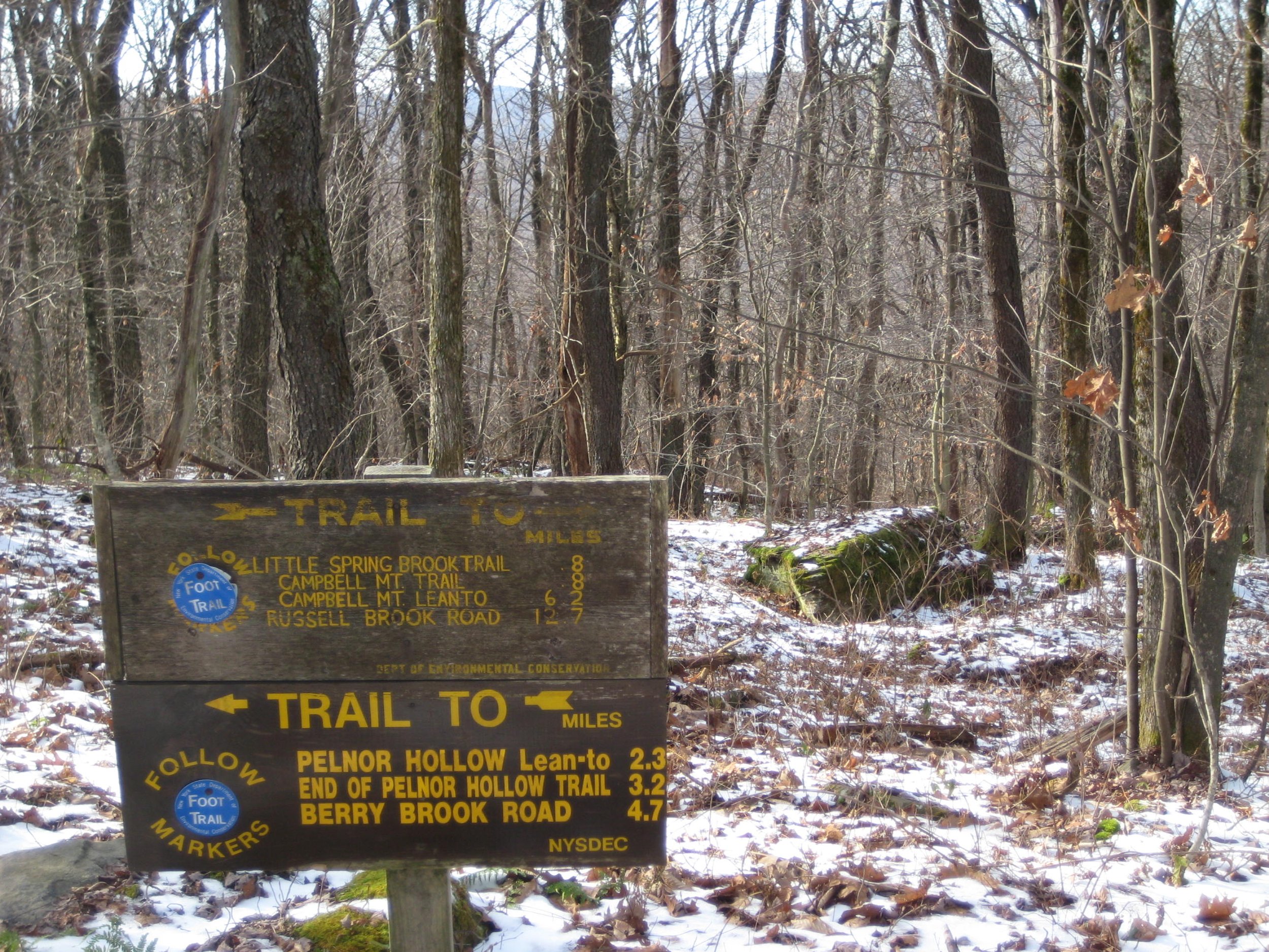
Hike the Mary Smith and Pelnor Hollow Trails
Take an 8.8-mile hike on these remote and seldom used trails in the Pepacton Range of the Western Catskills. Beginning at Holiday/Berry Brook Road, this out-and-back route will take us to the quiet reaches of Pelnor Hollow. This difficult hike is expected to take six hours and may be of interest to those working to complete the Catskills All Trail Challenge. Registration is limited to 12, and hikers must register by March 1. Register by contacting the leader, Al Purdy, at Albertpurdy1@aol.com or (845) 489-2332.
Participants need to bring lunch/ food, water/ beverage, layers of winter clothing, microspikes, snowshoes, gaiters, and trekking poles (recommended). Dogs are not permitted on this hike.
To reach the trailhead from NYS Thruway Exit 19, Kingston, turn right onto Route 28 west and follow for 46.4 miles. Turn left onto State Route 30 and follow for 18.8 miles around the Pepacton Reservoir. Turn left onto Holiday Brook/Berry Brook Road and follow for 2.9 miles to the DEC parking area on your left. (See address in upper left of this post.)

Hike to Southwest Hunter, Hunter, & Rusk Mountains
This a 12-mile trail hike and bushwack to SW Hunter (3753'), Hunter (4030'), and Rusk (3686') at a moderate pace (about 1-1/2 mph moving speed), with short breaks. This hike is rated as difficult and is expected to take ten hours. Participants should bring lunch/ snacks, water/ sports drink, sturdy shoes, proper clothing, hiking poles (recommended), a headlamp, and insect repellent. This event is limited to 12 participants and registration is required before April 4. To register, contact event leader Marv Freedman at marvfreedman@gmail.com Dogs are permitted on this hike with the permission of the event leader.
Directions: From NYS Thruway Exit 19 (Kingston) merge onto NY 28 west for 27.6 miles. Then take State Route 42 north for 7.3 miles then turn right on County Hwy 6 (Spruceton Road) in West Kill and take this road 6.6 miles to the Spruceton Trail Parking Lot on the left.
From State Route 23A at Lexington, take State Route 42 south for 4.1 miles then turn left on County Hwy 6 (Spruceton Road) in West Kill and take this road 6.6 miles to the Spruceton Trail Parking Lot on the left.
GPS Coordinates of Spruceton Trail Parking Lot: 42.18437, -74.27219
Additional Information: Meeting place and time, route details, and required gear are subject to change based on weather forecast, trail conditions, etc. Updated information will be provided via email, usually about 4 days before the hike.

TO BE RESCHEDULED Hike Blackhead, Black Dome, and Thomas Cole Mountains

This hike, which visits three 3900’ peaks, begins at the trailhead at the end of Big Hollow Road. We will ascend along the red trail to Lockwood Gap and then take the yellow trail to the summit of Blackhead Mountain. After returning to Lockwood Gap, we will ascend the red trail to Black Dome and then hike over to Thomas Cole Mountain. Retracing our steps, we will return to the trailhead for overall totals of 7.8 miles, 2600’ of elevation gain, and 4-5 hours. This hike is rated as difficult, and we will be moving at a pace of 1.5 – 2 miles per hour.
Participants need to bring lunch/ food, snacks, and sufficient water-hydration drink (at least 2L). Please pre-hydrate and calorie load the day before the hike and please bring electrolytes. Bring proper gear, including extra layers, hats and gloves, a puffer, outer shell, rain pants, any cold-weather gear you usually carry. Required: Hillsound Trail Crampons or Kahtoola Microspikes, and snowshoes (probably not needed, but have them for the bushwhack, just in case). Also required: a headlamp in good working order/extra batteries - two headlamps is better. A battery pack to recharge your phone, gps, headlamp is highly recommended. Also bring tick repellent, sunscreen, sunglasses Please verify that your gear is in good working order before you leave home. Gaiters can be very helpful in snow and wet conditions. Poles can be helpful for going up/down steep slopes and are practically a must with snowshoes.
This hike is limited to 12 participants, and registration is required by April 2. To register, contact Anne Rubin by email at annaswartz@netscape.net Dogs are permitted on this hike with the permission of the hike leader.
Directions: From NYS Thruway Exit 21 (Catskill) follow signs for Route 23 West (to Windham). Once on Route 23, go 20.5 miles (see signs for Big Hollow hiking and Maplecrest) and turn left onto Greene Co. Hwy 65. Go .8 of a mile on 65 and turn left onto Co. Hwy. 65A, which becomes Co. Hwy 40. Continue on 40 until the stop sign in 1.85 miles (with hiker wayfinding signs). Turn left onto Big Hollow Road and continue to DEC Trailhead at end (approx. 4.25 miles).
GPS Coordinates 42.28908, -74.11548
5646 Big Hollow Road, Maplecrest, NY 12454

Hike to Vly & Bearpen Mountains

We will hike to Vly (3541') and Bearpen (3587') at a moderate pace (about 1-1/2 mph moving speed) along unofficial trails and snowmobile trails, with short breaks. There are great views from Bearpen. This is a moderate-difficult, seven-mile hike that is expected to take five hours. Fit beginners are welcome. Participants should bring lunch/ snacks, water/ sports drink, sturdy shoes, proper clothing, hiking poles (recommended), and insect repellant.
This event is limited to 12 participants and registration is required before April 1. To register, contact event leader Marv Freedman at marvfreedman@gmail.com Dogs are permitted on this hike with the permission of the event leader.
Directions: Parking is limited at the trailhead, so we'll meet in the parking area across from the Highmount Post Office at 8 Galli Curci Road, in Highmount NY, just off of Route 28 and at the base of the Belleayre Ski Center. From the east, Highmount is located 37 miles west of the NYS Thruway Exit 19 on Route 28 at the top of the hill. From the west, Highmount is located 8.2 miles east of the village of Margaretville at the top of the hill.
GPS Coordinates for parking lot at Highmount: 42.146809, -74.49486
Additional Information: Meeting place and time, route details, and required gear are subject to change based on weather forecast, trail conditions, etc. Updated information will be provided via email, usually about 4 days before the hike.

Hike to Red Hill
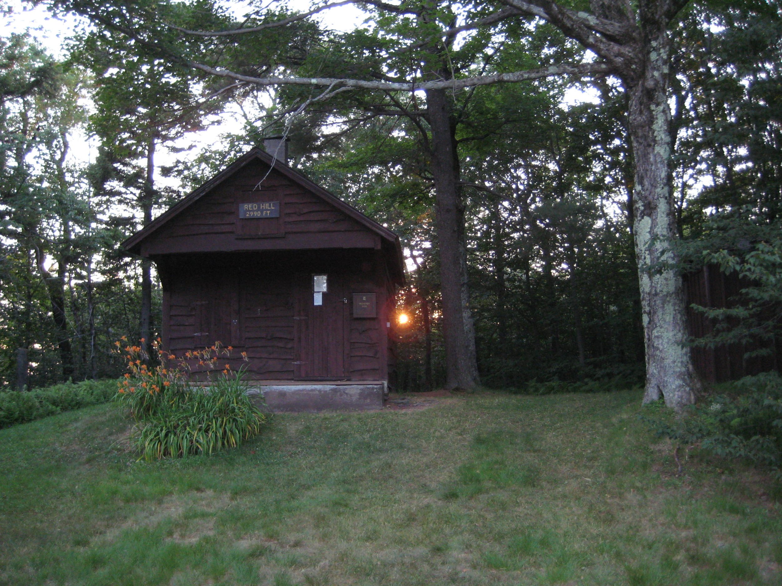
This is a four-mile out-and-back moderate hike to the summit of Red Hill, which has a fire tower! It's a great hike no matter what, and if you're engaged in the NYS Fire Tower Challenge for 2024, and you haven't gotten to Red Hill yet, this is a chance to do so. We will proceed at an accommodating pace and take a lunch break at the summit. Participants should bring lunch/ food, water/ beverage, proper clothing and equipment, sunscreen, insect repellent, and micro-spikes if icy.
This event is limited to 12 registrants, and the deadline to register is March 28. Register by emailing hike leader Peter Manning at Peter@catskillmountainclub.org (preferred) or via phone (607) 832-4413. Dogs are not permitted on this hike. Severe weather cancels; notification of cancelation will be via email the night before the hike.
Directions: From State Route 28 at Big Indian, take Ulster County Highway 47 south for 20.6 miles (becomes Sul. Co. Hwy 157) to the stop sign near Claryville. Turn left onto Denning Road and proceed 2.8 miles and the sign at the trailhead parking will be on your right.
From State Route 55 just west of Grahamsville, take the Claryville Road (Sul. Co. Hwy 19) for 7.4 miles and the sign at the trailhead parking will be on your right.
GPS Coordinates: 41.93520, -74.52925 (address 2205 Denning Rd., Claryville, NY).

Hike Bramley Mountain
Hike Bramley Mountain
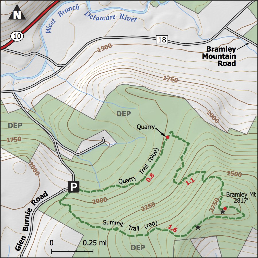
Join us for a First Day of Spring hike to the summit of Bramley Mountain, future site of the Catskills' newest fire tower. This moderately difficult hike passes through a quarry before passing a number of impressive rock outcroppings. The summit offers panoramic views to the high peaks and the mountains that form the Pepacton Range on the south side of the reservoir. We will hike at a moderate pace and take time to have lunch and enjoy the views when we reach the summit.
This four-mile hike is expected to take four hours. Participants should bring lunch/ food, water/ beverage. Dress in layers of moisture wicking fabrics and wear good hiking shoes. Bring ice traction devices and snowshoes, depending on conditions. Hiking poles are recommended. Maps are available at the trailhead.
Hikers must register by March 17 by contacting leader Wendell George at wendell@catskillmountainclub.org or (845) 514-6959. The event is limited to 12 people. Dogs are permitted with the leader’s permission.
Meet at the northern trailhead. The trailhead is located on Glen Bernie Road in Delhi, seven-tenths of a mile south of the intersection with County Rt 18, or 3.3 miles north of SR 28. Take State Rt. 28 to Glen Bernie Road (4.7 miles east of Delhi; 7.6 miles west of Andes). After turning on Glen Bernie, go 3.3 miles to the trailhead on the right. From County Hwy 18, take Glen Bernie Road .7 miles and the trailhead is on the left.
GPS Coordinates 42.2993, -74.8360
Additional Information: Dogs must be well behaved around people and other dogs. Be prepared to leash when approaching other parties.
Hike is subject to cancellation or postponement due to hazardous weather conditions.
Comments: Questions about this event and registrations can be directed to: wendell@catskillmountainclub.org or call 845-514-6959. Provide your contact information for use on the morning of the hike in case there is a change in plans. Please be sure to notify the leader asap if you need to cancel your registration.

Hike the Mary Smith and Pelnor Hollow Trails
Take an 8.8-mile hike on these remote and seldom used trails in the Western Catskills. Beginning at Holiday/Berry Brook Road, this out-and-back route will take us to the quiet reaches of Pelnor Hollow. This difficult hike is expected to take six hours and may be of interest to those working to complete the Catskills All Trail Challenge. Registration is limited to 12, and hikers must register by March 1. Register by contacting the leader, Al Purdy, at Albertpurdy1@aol.com or (845) 489-2332.
Participants need to bring lunch/ food, water/ beverage, layers of winter clothing, microspikes, snowshoes, gaiters, and trekking poles (recommended). Dogs are not permitted on this hike.
To reach the trailhead from NYS Thruway Exit 19, Kingston, turn right onto Route 28 west and follow for 46.4 miles. Turn left onto State Route 30 and follow for 18.8 miles around the Pepacton Reservoir. Turn left onto Holiday Brook/Berry Brook Road and follow for 2.9 miles to the DEC parking area on your left.

Onteora Lake & Bluestone Wild Forest
We will be hiking the Onteora Lake Loop, the Red Eft Trail, and the Bluestone Loop Trail -- all needed to complete the Catskill All Trails Challenge. This is a moderate, 7.8-mile loop that is expected to take four to five hours. This event is limited to 12 participants and registration is required by February 23. To register, contact Al Purdy Albertpurdy1@aol.comm or (845) 489-2332. Hikers should bring lunch/ snacks, water/ beverage, sturdy hiking boots, winter layers, microspikes, snowshoes, gaiters, and trekking poles. Dogs are not permitted on this hike.
Directions: From NYS thruway Exit 19 at Kingston, turn right onto Route 28 West and follow for 3.8 miles to the Onteora Lake parking areas upper lot. From the west on Route 28, the left turn to Onteora Lake, marked with brown and white signs, is .85 east of the traffic light at the Stewart’s Shop in West Hurley.
Conditions permitting, drive up the dirt road to the interior/ upper parking lot for Onteora Lake. GPS coordinates: 41.9815 - 74.0855


Hike to Split Rock Overlook via Little Spring Brook

Here is a moderate four-mile out-and-back hike in the lesser-known Western Catskills. Al Purdy will lead hikers from the Little Spring Brook approach to the Split Rock Overlook and the junction of the Pelnor Hollow and Mary Smith Trails. This hike begins at 8:30 AM is expected to take three to four hours. In addition to food/ snacks and water/ beverages, hikers need to bring snowshoes, microspikes, trekking poles, gaiters, layers of winter clothing. Dogs are not permitted on this hike. This hike is limited to 12 participants and registration is required. Register by contacting Al Purdy at Albertpurdy1@aol.com or (845) 489-2332 by February 16.
Directions:
From NYS Thruway Exit 19 Kingston, turn right onto Route 28 West and follow for 46.4 miles. Turn left onto route 30 follow for 19.9 miles. Make a left onto route 206 (Cat Hollow Road) and follow for 4.9 miles. Turn left onto Little Spring Brook Road follow 1.2 miles to the parking area on your right across from the turnaround.
From Route 17 Roscoe exit, take Old Rte 17/ Route 206 north for 6.1 miles (from Main St. Roscoe) and turn right onto Spur Road which becomes Little Spring Brook Road. Follow for 1.2 miles to the parking area on your right across from the turnaround.
GPS Coordinates: 42.02788 -74.87786

Hike to Eagle and Haynes Mountains

This 8.2-mile hike begins and concludes in McKenley Hollow. Rated as difficult, the outing is expected to take six hours. Participants need to bring lunch, winter clothes, sturdy boots, microspikes, gaiters, as well as snowshoes, poles, and a snow shovel. The event is limited to 12 hikers, and registration is required by January 12. To register, contact Al Purdy at Albertpurdy1@aol.com or (845) 489-2332. Dogs are not permitted on this hike.
Directions: From NYS Thruway Exit 19 Kingston, take Route 28 West for 31 miles and turn left onto Ulster County Route 47 in Big Indian. Follow 47 for 2.9 miles and turn right onto McKenley Hollow Road. Go 0.8 miles and the parking area is on the left.
From Route 28 West, Big Indian is 4.1 miles east of Highmount (Belleayre Ski Center). Turn right onto 47 and follow directions to McKenley Hollow above.
GPS Coordinates: 42.07038, -74.47395
207 McKenley Hollow Rd, Shandaken, NY 12410

Beaver Kill Ridge Hike
Join Al Purdy on this 6.7-mile out and back hike along the Monguap-Hardenburgh Trail to the junction with the Long Pond-Beaver Kill Range Trail. Beginning at 8:30 AM on Sunday, February 4, this hike is rated as difficult and is expected to take four hours to complete. This outing may be ideal for Catskill All Trails aspirants looking to complete the network of trails in this area of the mountains. Participants should bring lunch, water/ drink, as well as clothes for a winter hike, snowshoes, microspikes, treking poles, gaiters, and extra layers of clothes. Participants must register for this hike by February 2 by contacting Al Purdy at Albertpurdy1@aol.com or (845) 489-2332. Please note, this hike is limited to 12 people and dogs are not permitted.
Directions from NYS Thruway, Kingston/ Exit 19. Turn right onto State Route 28 West and follow for 46.3 miles and turn left onto State Route 30. After crossing the reservoir bridge at 8.3 miles, turn immediately left onto Board of Water Supply (BWS) Road # 8 and follow for 1.9 miles. Stay to the right – this becomes Barkaboom Road. From here, continue 6.3 miles to the terminus of this road. Turn left onto Beaver Kill Road and travel 7.4 miles. The parking area/ trailhead is on the right. GPS coordinates of trailhead: 42.01256, -74.62335 Note, travel on Cross Mountain Road (a different route than described above) is not recommended at this time of year.
From State Route 17, Livingston Manor exits, go west on Old Route 17 and less than one mile from the Route 17 overpass (just west of Liv. Manor) turn right onto Beaverkill Road. Take Beaverkill Road (which begins as Sullivan Co. Hwy 151/ becomes Ulster Co. Hwt 54 at 8 miles) for 18.3 miles and the parking area/ trailhead is on the right. GPS coordinates of trailhead: 42.01256, -74.62335

Hike to Frick Pond in the Willowemoc Wild Forest, January 21, 8:30 AM

Join Al Purdy for this 6.35 moderate-difficult hike that will include the Loggers Loop and Big Rock Trail, as well as sections of the Flynn and Quick Lake Trails. The outing is expected to take four hours, and participants must register by January 5. To register, contact Al Purdy at Albertpurdy1@aol.com or (845) 489-2332. Hikers need to bring lunch, warm clothes, sturdy boots, micro-spikes, gaiters, a headlamp, as well as snowshoes and poles. This hike is limited to 12 registrants and dogs are not permitted.
Directions: From NYS Route 17 westbound, take exit 96W and turn left onto DeBruce Road. Continue on DeBruce Road 5.6 miles to Mongaup Road. Turn left onto Mongaup Road and drive 2.7 miles to where the road splits. Stay left on Beech Mountain Road and drive .3 miles to the parking area on the left.
From NYS Route 17 eastbound, take exit 96E and turn right at the end of the exit. Proceed .1 mile to stop sign, turn left, then take the next left onto DeBruce Rd. You will soon see a "red caboose" on left. Continue on DeBruce Road 5.6 miles to Mongaup Road. Turn left onto Mongaup Road and drive 2.7 miles to where the road splits. Stay left on Beech Mountain Road and drive .3 miles to the parking area on the left.
From the NYS Thruway Exit 19 (Kingston) turn right onto Route 28 west, go one-half mile and turn right onto US 209 south. Take 209 south for 25 miles and turn right onto State Route 55 in Napanoch. Take 55 West for 16.1 miles and turn right onto Sullivan County Hwy 19 (Claryville Road). Go 2.7 miles and turn left onto Hunter Rd. Take Hunter Rd. for 5.5 miles and turn left onto Willowemoc Rd. Take Willowemoc Rd. for 3.6 miles and turn right onto Mongaup Rd. for 2.7 miles. Continue straight onto Beech Mountain road 0.3 miles to the Frick Pond parking area.
GPS Coordinates: 41.95171, -74.70711

Hike to Eagle and Haynes Mountains, January 14 8:30 AM
This 8.2-mile hike begins and concludes in McKenley Hollow. Rated as difficult, the outing is expected to take six hours. Participants need to bring lunch, winter clothes, sturdy boots, microspikes, gaiters, as well as snowshoes, poles, and a snow shovel. The event is limited to 12 hikers, and registration is required by January 12. To register, contact Al Purdy at Albertpurdy1@aol.com or (845) 489-2332. Dogs are not permitted on this hike.
Directions: From NYS Thruway Exit 19 Kingston, take Route 28 West for 31 miles and turn left onto Ulster County Route 47 in Big Indian. Follow 47 for 2.9 miles and turn right onto McKenley Hollow Road. Go 0.8 miles and the parking area is on the left.
From Route 28 West, Big Indian is 4.1 miles east of Highmount (Belleayre Ski Center). Turn right onto 47 and follow directions to McKenley Hollow above.
GPS Coordinates: 42.07038, -74.47395

First Day Hike to West Kill Mountain

Join CMC for a seven-mile round-trip hike to West Kill Mountain from Diamond Notch. In partnership with NYSDEC we continue the tradition of welcoming the new year with a Catskill Mountain hike. This challenging trail route will take us to the summit of West Kill (3880’) and the nearby lookout points. With an elevation gain of 1785 feet, this hike is rated as difficult and is expected to take five-to-six hours. Participants should be prepared for wintery trail conditions and bring microspikes and snowshoes, as applicable. Hikers should be experienced in cold weather mountain outings and will need to bring proper gear and supplies, including layered and extra clothing, sturdy warm boots, gaiters, sunglasses, as well as food/ snacks, and water/ beverage/ thermos. We will pause at Buck Ridge Lookout for lunch.
The hike is limited to 12 participants and registration is required. Please register by December 30 by contacting Peter@catskillmountainclub.org or (607) 832-4413. Extreme weather or trail conditions will cancel. Dogs are not permitted on this hike.
Directions: From NYS Thruway Exit 19 (Kingston) merge onto NY 28 west for 27.6 miles. Then take State Route 42 north for 7.3 miles then turn right on County Hwy 6 (Spruceton Road) in West Kill and take this road 6.8 miles to the trailhead on the right, almost to the end of the road.
From State Route 23A at Lexington, take State Route 42 south for 4.1 miles then turn left on County Hwy 6 (Spruceton Road) in West Kill and take this road 6.8 miles to the trailhead on the right, almost to the end of the road. Note, this parking lot is on the right just past the Spruceton Trail Parking Lot (which is on the left). Do not park at the end of the road; that is a snow plow turnaround.
Diamond Notch Parking Lot GPS Coordinates: 42.18240 -74.26955

Hike Thomas Cole and Black Dome Mountains, and the Camel’s Hump

Take this 7.4-mile out and back hike along the Black Dome Range Trail.
Beginning at 8:30 AM at the parking area on Barnum Road, this hike is rated as difficult and is expected to take approximately six hours. To register for this hike contact Al Purdy at Albertpurdy1@aol.com or (845) 489-2332 by December 22. Participants need to bring lunch/ snacks, water/ beverage, warm clothing, sturdy hiking boots, gaiters spikes, poles, and headlamp. Have snowshoes with you. This hike has a maximum of twelve hikers, and dogs are not permitted. Severe weather will postpone the hike.
Directions: From NYS Thruway (87) Saugerties/ Exit 20, turn right on 32 North for six miles and keep straight onto NY-32A. Take NY-32A for 0.6 miles, bear left onto NY-23A. Take Route 23A for 5.5 mi. and turn right onto Co. Hwy 25. At 2.8 mi. stay right onto Co. Hwy 23C; in another four miles turn right onto Co. Hwy 40. In 1.1 mi. turn right onto Hauser Rd for 0.5 mi./ end. Turn right onto Barnum Road and trailhead parking is 0.4 mi. Google address is 323 Barnum Rd., East Jewett NY, 12424. GPS Coordinates are 42.26399, -74.17666

Loop Hike from Mongaup Pond

This 10-mile hike, rated as difficult, will include sections of the Mongaup-Hardenburgh Trail, the Long Pond-Beaverkill Range Trail, and the Mongaup-Willowemoc Trail. The hike is expected to take six-to-eight hours. Participants must register by December 15. To register, contact Al Purdy at Albertpurdy1@aol.com or (845) 489-2332. The event is limited to 12 participants. Dogs are not permitted on this hike. Participants need to bring lunch/ snacks, bright winter clothes/ layers, sturdy hiking boots, spikes, poles, gaiters, snowshoes, and head lamp. Though this is a trailed route, the hike may involve some route finding.
Directions: From NYS Route 17 westbound, take exit 96W and turn left onto DeBruce Road. Continue on DeBruce Road 5.6 miles to Mongaup Road. Turn left onto Mongaup Road and drive 2.7 miles to where the road splits. Turn right onto Mongaup Pond road for 1.1 miles to the Mongaup Pond Parking Area facing the lake.
From NYS Route 17 eastbound, take exit 96E and turn right at the end of the exit. Proceed .1 mile to stop sign, turn left, then take the next left onto DeBruce Rd. You will soon see a “red caboose” on left. Continue on DeBruce Road 5.6 miles to Mongaup Road. Turn left onto Mongaup Road and drive 2.7 miles to where the road splits. Turn right onto Mongaup Pond road for 1.1 miles to the Mongaup Pond Parking Area facing the lake.
From the NYS Thruway Exit 19 (Kingston) turn right onto Route 28 west, go one-half mile and turn right onto US 209 south. Take 209 south for 25 miles and turn right onto State Route 55 in Napanoch. Take 55 West for 16.1 miles and turn right onto Sullivan County Hwy 19 (Claryville Road). Go 2.7 miles and turn left onto Hunter Rd. Take Hunter Rd. for 5.5 miles and turn left onto Willowemoc Rd. Take Willowemoc Rd. for 3.6 miles and turn right onto Mongaup Rd. for 2.7 miles to where the road splits. Turn right onto Mongaup Pond road for 1.1 miles to the Mongaup Pond Parking Area facing the lake.
GPS Coordinates: 41.95829, -74.69112

Hike to Quick Lake, and Frick and Hodge Ponds

Join Al Purdy for a longer hike in the Willowemoc State Forest. The hike is rated difficult not for the terrain but for the distance (14.5 miles). The hike will visit the three water bodies and is ideal for those looking to complete the Catskills All Trails Hiking Challenge. This hike is expected to take eight hours, and participants need to bring lunch/ snacks, water/ beverage, proper clothing, bright colors for hunting season, headlamp, sturdy hiking boots, and microspikes (snowshoes should be in your car).
The hike is limited to 12 registrants. The registration deadline in November 25. Register by contacting Al Purdy at Albertpurdy1@aol.com or (845) 489-2332. Dogs are not permitted on this hike.
Directions:
From NYS Route 17 westbound, take exit 96W and turn left onto DeBruce Road. Continue on DeBruce Road 5.6 miles to Mongaup Road. Turn left onto Mongaup Road and drive 2.7 miles to where the road splits. Stay left on Beech Mountain Road and drive .3 miles to the parking area on the left.
From NYS Route 17 eastbound, take exit 96E and turn right at the end of the exit. Proceed .1 mile to stop sign, turn left, then take the next left onto DeBruce Rd. You will soon see a “red caboose” on left. Continue on DeBruce Road 5.6 miles to Mongaup Road. Turn left onto Mongaup Road and drive 2.7 miles to where the road splits. Stay left on Beech Mountain Road and drive .3 miles to the parking area on the left.
From the NYS Thruway Exit 19 (Kingston) turn right onto Route 28 west, go one-half mile and turn right onto US 209 south. Take 209 south for 25 miles and turn right onto State Route 55 in Napanoch. Take 55 West for 16.1 miles and turn right onto Sullivan County Hwy 19 (Claryville Road). Go 2.7 miles and turn left onto Hunter Rd. Take Hunter Rd. for 5.5 miles and turn left onto Willowemoc Rd. Take Willowemoc Rd. for 3.6 miles and turn right onto Mongaup Rd. for 2.7 miles. Continue straight onto Beech mountain road 0.3 miles to the Frick Pond parking area.
GPS Coordinates: 41.95171, -74.70711
Additional Notes: Hike begins at 8:30. At Quick Lake we will be over seven miles from the parking area, so make sure you have everything you think you may need with you. Most of the elevation gain will be on the return trip from Quick Lake to the parking area.

Hike to Overlook Mountain and Echo Lake

This is an 11.6-mile hike from Platte Clove to Overlook Mountain and back. The day’s journey will include the Overlook Mountain Fire Tower, Codfish Point, and Echo Lake. Rated as difficult, this hike is expected to take eight hours. The hike requires registration by Friday, November 17 and is limited to 12 people. Participants need to bring lunch/ snacks, water/ beverage, headlamp, sturdy boots, and proper clothing, including bright orange clothing. Dogs are not permitted on this hike. To register contact Al Purdy at Albertpurdy1@aol.com or (845) 489-2332.
The hike begins at the parking area at 2425 Platte Clove Rd, Elka Park, NY 12427. From the NYS Thruway Saugerties Exit 20 NORTH turn left onto NYS Route 212, cross the Thruway, and then turn right onto right onto NYS Route 32 North. (Follow directions below.) From the NYS Thruway Saugerties Exit 20 SOUTH, turn right onto NYS Route 32 North and follow the directions below.
From Exit 20 follow NYS Route 32 North for 5.8 miles. Then continue straight onto NYS Route 32a for 1.9 miles. Turn left at the light onto NYS Route 23a for 6.5 miles to South Main Street in Tannersville (see brown-and-white signs for Devil’s Path). Turn left onto South Main and continue to Railroad Ave. Turn left and continue onto Platte Clove Road (County Hwy 16). From the sharp bend to the left (intersection with Bloomer Road, with signs for Long Path), continue 5.2 miles and the short driveway to the parking area (marked Long Path) is on the left. Meet here and be ready to go at 8:30. GPS Coordinates: 42.13387, -74.08188

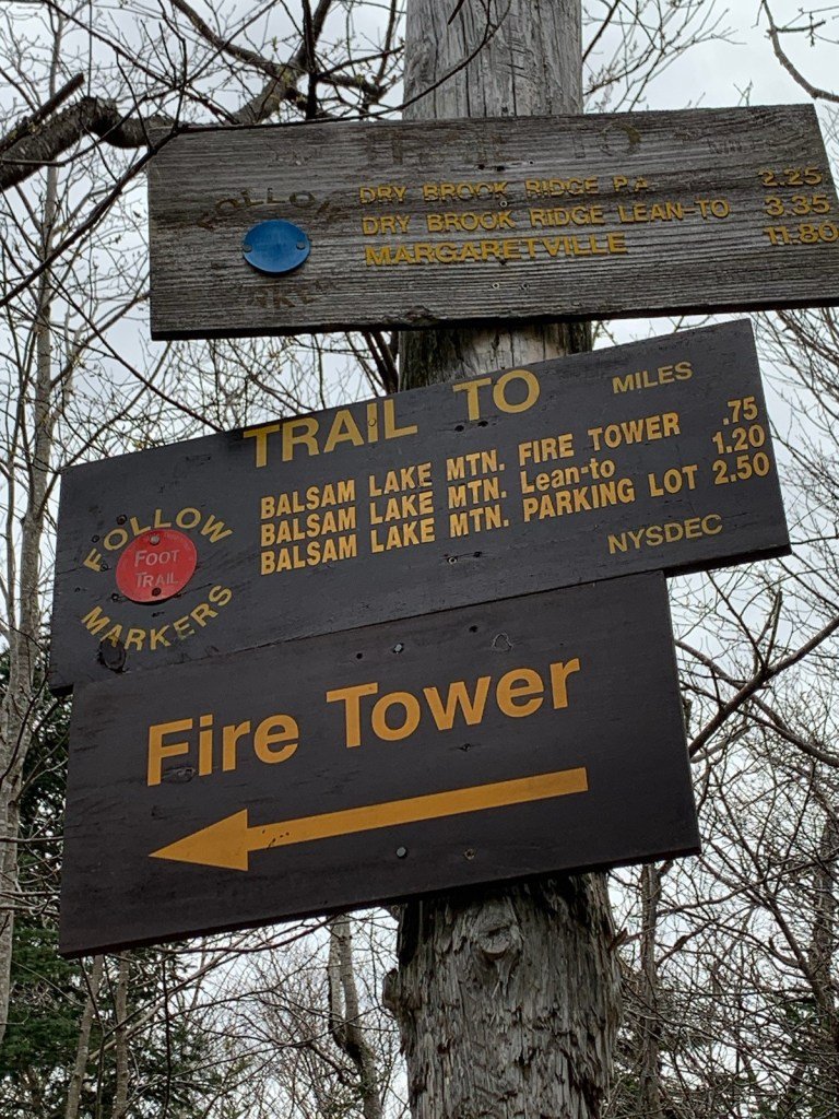
Invitation to Prospective CMC Event Leaders: Hike to Balsam Lake Mountain
Join us on this 5.9-mile out-and-back hike to the Balsam Lake Fire Tower. Along the way we’ll do some trail maintenance and discuss peoples’ interest in leading events for the CMC in 2024 and the Club’s guidelines for leaders. This hike is considered moderate, and we’ll break for lunch at the summit.
Registration is required and the hike is limited to 12 people. To register, contact Peter Manning by Saturday, November 11, 5PM at Peter@catskillmountainclub.org or (607) 832-4413. Bring lunch/ snacks, water/ beverage, proper clothing, and sturdy hiking boots. Dogs are not permitted on this hike.
The hike will begin at 9 AM at the Dry Brook Ridge Parking Area on Millbrook Road, 8.25 miles from Arkville. To reach Arkville from the NYS Thruway (Kingston Exit 19), take Route 28 west for 42 miles. Following the brown-and-white directional signs for Dry Brook Ridge, turn left on Dry Brook Road and go six mile; turn right on Millbrook Road and go just over two miles and the parking area will be on your right.
To reach Arkville from Delhi, take Route 28 south for 25 miles, follow brown-and-white directional signs for Dry Brook Ridge by turning right onto Dry Brook Road, then follow directions above.
GPS Coordinates for Dry Brook Ridge Parking Area: 42.07036, -74.57387

Hike Hunter Mtn Fire Tower, Colonels Chair, and John Robb Lean-To
This counter-clockwise loop will begin at 8:30 AM the end of Spruceton Road. Participants will visit Diamond Notch Falls, Geiger Point, Hunter Mountain Fire Tower, Colonels Chair, and the John Robb Lean-To. This 10.5-mile trail hike is rated as difficult and will take six-to-eight hours. Hikers need to bring lunch/ snacks, water/ beverage, proper clothing — layers, extra jacket, good hiking shoes, and a headlamp or flashlight.
Registration is required by 10/27. To register, contact Al Purdy at Albertpurdy1@aol.com or (845) 489-2332. This hike is limited to 12 people, so register early! No dogs are permitted on this hike. Severe weather will cancel the hike.
Directions:
From NYS Thruway Exit 19 (Kingston) merge onto NY 28 west for 27.6 miles. Then take State Route 42 north for 7.3 miles then turn right on County Hwy 6 (Spruceton Road) in West Kill and take this road 6.8 miles to the trailhead on the right, almost to the end of the road.
From State Route 23A at Lexington, take State Route 42 south for 4.1 miles then turn left on County Hwy 6 (Spruceton Road) in West Kill and take this road 6.8 miles to the trailhead on the right, almost to the end of the road.
GPS coordinates: 42.18240, -74.26955

Hike Ashokan High Point

This 9-mile hike begins at the Kanape Brook Trailhead and features a loop path that includes the summit of Ashokan High Point (3080’). Rated as difficult, there is 2150 feet of elevation gain and the overall journey is expected to take six hours.
Space is limited to 12 hikers, so please register early. Participants must register by November 3. Register by contacting Al Purdy at Albertpurdy1@aol.com or (845) 489-2332. Participants need to bring lunch/ snacks, water/ drinks, a headlamp, layered clothing/ rain/ snow protection, sturdy hiking boots, microspikes, a headlamp (preferred) or flashlight, and bright clothes for hunting season. Dogs are not permitted on this hike. Severe weather will postpone the hike.
To reach the Kanape Brook Trailhead from the Kingston/ Exit 19 of the NYS Thruway, follow State Route 28 west for 16.3 miles to Boiceville. Turn left onto Route 28A, follow for 3 miles, turn right onto Watson Hollow Road (Co. Hwy. 42) and follow for 4.1 miles to the Kanape Brook Parking Area on the right (821 Watson Hollow Road West Shokan, NY, 12494). GPS coordinates of Kanape Brook PA: 41.93579, -74.32827.
From the west on Route 28, Boiceville and the intersection with 28A is located 1.7 west east of the Catskills Visitors Center and 6.4 miles east of Phoenicia (intersection of State Routes 28 and 214). From Boiceville, follow the directions above to reach the Kanape Brook Parking Area (GPS coordinates: 41.93579, -74.32827.)
Hike Balsam Lake Mountain from Alder Lake

Hike this out-and-back journey along the beautiful Millbrook Ridge Trail to the spectacular summit views from the Balsam Lake Mountain Fire Tower. This hike is rated difficult for its length (13.8 miles/ approx. 8 hours), but we will travel along trails the whole way. Stops include the Beaver Meadow Lean-to, the Beecher Lake Overlook, and of course the fire tower.
Space is limited to 12 hikers, so please register early. Participants must register by October 20. Register by contacting Al Purdy at Albertpurdy1@aol.com or (845) 489-2332. Participants need to bring lunch/ snacks, water/ drinks, a headlamp, layered clothing/ rain protection, sturdy hiking boots, a headlamp (preferred) or flashlight, and bright clothes for hunting season. Dogs are not permitted on this hike.
From NYS Thruway Exit 19 at Kingston, take State Route 28 west to 45.5 miles past Margaretville. Less than 2 miles past Margaretville, turn left and a quick right onto BWS Road No. 10 and continue for 8.3 miles. Turn left onto Barkaboom Road (toward Big Pond and Little Pond) and continue 6.2 miles to the stop sign. Turn left onto Beaverkill road for 1.4 miles; then turn left onto Alder Road for 2.2 miles. Turn right onto cross mountain road for 100 ft. and follow the dirt road to the parking area for Alder Lake. (*Note: do not follow directions to take Cross Mountain Road.)
From Route 28 North, go south to Andes, make a right and then bear left onto Delaware County Highway 1 (following signs for Shavertown). Reach the stop sign at just under 8 miles, turn right, go over the reservoir bridge, and turn left onto BWS Road No. 8. At 1.9 miles stay to the right and from this point continue 6.2 miles to the stop sign. Turn left onto Beaverkill road for 1.4 miles; then turn left onto Alder Road for 2.2 miles. Turn right onto cross mountain road for 100 ft. and follow the dirt road to the parking area for Alder Lake.
Other Catskill Region Events
Don’t see a scheduled event that works for you? Try the schedules of these other Catskill area hiking clubs and organizations.
-

Catskill 3500 Club
The Catskill 3500 Club was founded in 1962 to foster interest in hiking in the Catskills. Membership is open to anyone who has climbed on foot each of the 35 Catskill peaks above 3500 feet in elevation. The club’s schedule appears in their newsletter, The Canister.
-

New York-New Jersey Trail Conference
The New York-New Jersey Trail Conference builds, maintains and protects 2,000 miles of trail in New York & New Jersey, including 29 lean-tos and over 200 miles of trails in the Catskills, by mobilizing volunteers. Learn more about Catskill programs and upcoming volunteer opportunities.
-

Triple Cities Hiking Club
The Binghamton based Triple Cities Hiking Club has been active since 1947 in promoting access to hiking opportunities. Hikes are scheduled on most weekends throughout the year and range in degree of challenge from easy outings to very strenuous hikes, including in the Catskills.
-

Finger Lakes Trail Conference
The FLTC was founded in 1962. It works in cooperation with its members and various organizations to develop and maintain a premier hiking trail system in New York. Learn more about the trail and find out how to help.
-

Fats in the Cats Bicycle Club
The Fats in the Cats Bicycle Club, an IMBA Chapter, promotes cycling advocacy, trail building, trail maintenance and community service. Since 1994, the club has been advocating, stewarding and improving many of the best places to ride a mountain bike in New York’s Catskill Park and Hudson Valley Region. In addition, the club organizes group rides and gives away dozens of bikes to needy kids every holiday season.